You are here: Home > Network List > TA - USArray Transportable Network (new EarthScope stations) Stations List
> Station M54A Oil Creek State Park, Oil City, PA, USA > Earthquake Result Viewer
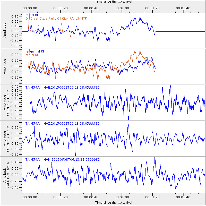
M54A Oil Creek State Park, Oil City, PA, USA - Earthquake Result Viewer
*The percent match for this event was below the threshold and hence no stack was calculated.
| Earthquake location: |
Hokkaido, Japan Region |
| Earthquake latitude/longitude: |
41.5/142.0 |
| Earthquake time(UTC): |
2015/06/08 (159) 06:01:08 GMT |
| Earthquake Depth: |
44 km |
| Earthquake Magnitude: |
6.2 MO |
| Earthquake Catalog/Contributor: |
NEIC PDE/NEIC ALERT |
|
| Network: |
TA USArray Transportable Network (new EarthScope stations) |
| Station: |
M54A Oil Creek State Park, Oil City, PA, USA |
| Lat/Lon: |
41.51 N/79.66 W |
| Elevation: |
488 m |
|
| Distance: |
89.2 deg |
| Az: |
29.926 deg |
| Baz: |
330.049 deg |
| Ray Param: |
$rayparam |
*The percent match for this event was below the threshold and hence was not used in the summary stack. |
|
| Radial Match: |
54.225456 % |
| Radial Bump: |
400 |
| Transverse Match: |
55.63982 % |
| Transverse Bump: |
400 |
| SOD ConfigId: |
7422571 |
| Insert Time: |
2019-04-19 05:54:23.803 +0000 |
| GWidth: |
2.5 |
| Max Bumps: |
400 |
| Tol: |
0.001 |
|
Signal To Noise
| Channel | StoN | STA | LTA |
| TA:M54A: :HHZ:20150608T06:13:28.059998Z | 2.4882545 | 2.8332084E-7 | 1.1386329E-7 |
| TA:M54A: :HHN:20150608T06:13:28.059998Z | 0.7583813 | 8.133475E-8 | 1.0724782E-7 |
| TA:M54A: :HHE:20150608T06:13:28.059998Z | 0.65474683 | 8.31422E-8 | 1.2698374E-7 |
| Arrivals |
| Ps | |
| PpPs | |
| PsPs/PpSs | |


