You are here: Home > Network List > TA - USArray Transportable Network (new EarthScope stations) Stations List
> Station O48A Farmland, IN, USA > Earthquake Result Viewer
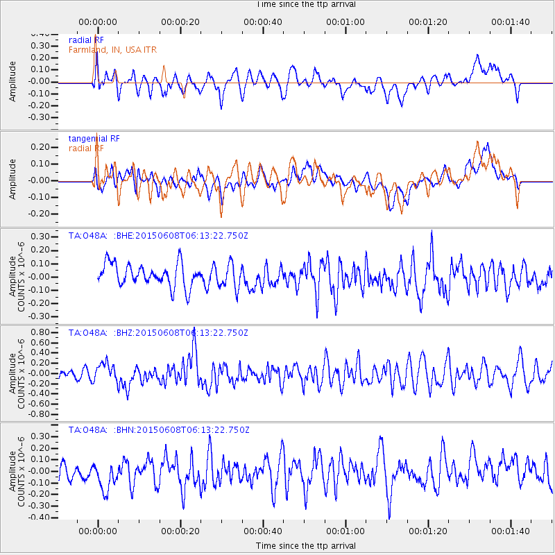
O48A Farmland, IN, USA - Earthquake Result Viewer
*The percent match for this event was below the threshold and hence no stack was calculated.
| Earthquake location: |
Hokkaido, Japan Region |
| Earthquake latitude/longitude: |
41.5/142.0 |
| Earthquake time(UTC): |
2015/06/08 (159) 06:01:08 GMT |
| Earthquake Depth: |
44 km |
| Earthquake Magnitude: |
6.2 MO |
| Earthquake Catalog/Contributor: |
NEIC PDE/NEIC ALERT |
|
| Network: |
TA USArray Transportable Network (new EarthScope stations) |
| Station: |
O48A Farmland, IN, USA |
| Lat/Lon: |
40.26 N/85.16 W |
| Elevation: |
300 m |
|
| Distance: |
88.1 deg |
| Az: |
34.125 deg |
| Baz: |
326.566 deg |
| Ray Param: |
$rayparam |
*The percent match for this event was below the threshold and hence was not used in the summary stack. |
|
| Radial Match: |
58.334137 % |
| Radial Bump: |
400 |
| Transverse Match: |
58.33382 % |
| Transverse Bump: |
400 |
| SOD ConfigId: |
7422571 |
| Insert Time: |
2019-04-19 05:54:27.586 +0000 |
| GWidth: |
2.5 |
| Max Bumps: |
400 |
| Tol: |
0.001 |
|
Signal To Noise
| Channel | StoN | STA | LTA |
| TA:O48A: :BHZ:20150608T06:13:22.750Z | 2.1739733 | 1.8274692E-7 | 8.4061256E-8 |
| TA:O48A: :BHN:20150608T06:13:22.750Z | 1.2901461 | 1.4088859E-7 | 1.0920359E-7 |
| TA:O48A: :BHE:20150608T06:13:22.750Z | 1.1147566 | 9.3723045E-8 | 8.40749E-8 |
| Arrivals |
| Ps | |
| PpPs | |
| PsPs/PpSs | |


