CTAO Charters Towers, Australia - Earthquake Result Viewer
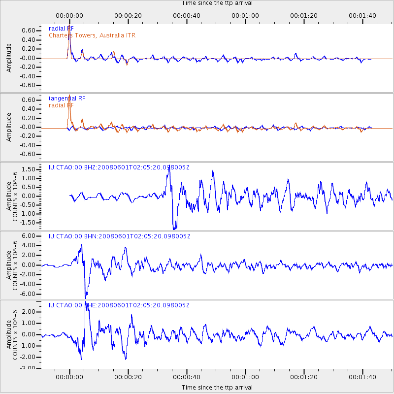
Earthquake location: Philippine Islands Region
Earthquake latitude/longitude: 20.1/121.4
Earthquake time(UTC): 2008/06/01 (153) 01:57:24 GMT
Earthquake Depth: 35 km
Earthquake Magnitude: 6.0 MB, 6.2 MS, 6.3 MW, 6.2 MW
Earthquake Catalog/Contributor: WHDF/NEIC
Network: IU Global Seismograph Network (GSN - IRIS/USGS)
Station: CTAO Charters Towers, Australia
Lat/Lon: 20.09 S/146.25 E
Elevation: 357 m
Distance: 46.8 deg
Az: 147.149 deg
Baz: 327.158 deg
Ray Param: 0.0703342
Estimated Moho Depth: 40.0 km
Estimated Crust Vp/Vs: 1.69
Assumed Crust Vp: 6.522 km/s
Estimated Crust Vs: 3.87 km/s
Estimated Crust Poisson's Ratio: 0.23
Radial Match: 94.90399 %
Radial Bump: 290
Transverse Match: 71.748375 %
Transverse Bump: 400
SOD ConfigId: 2504
Insert Time: 2010-03-03 14:15:56.695 +0000
GWidth: 2.5
Max Bumps: 400
Tol: 0.001

Signal To Noise

ChannelStoNSTALTA
IU:CTAO:00:BHN:20080601T02:05:20.098005Z9.704611.7951745E-61.8498163E-7
IU:CTAO:00:BHE:20080601T02:05:20.098005Z6.209578.6412854E-71.3916078E-7
IU:CTAO:00:BHZ:20080601T02:05:20.098005Z5.2757156.876177E-71.3033642E-7
Arrivals
Ps4.5 SECOND
PpPs15 SECOND
PsPs/PpSs20 SECOND