CTAO Charters Towers, Australia - Earthquake Result Viewer
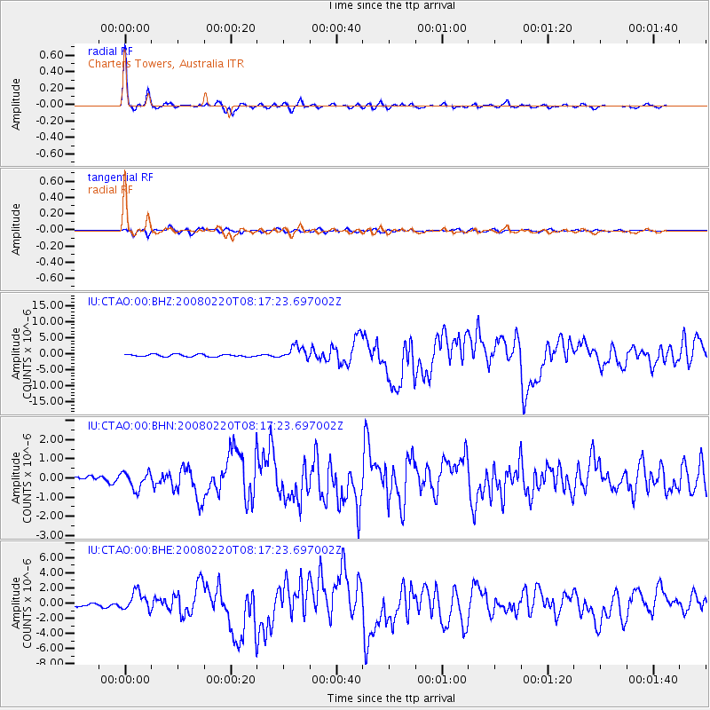
Earthquake location: Off W Coast Of Northern Sumatra
Earthquake latitude/longitude: 2.8/96.0
Earthquake time(UTC): 2008/02/20 (051) 08:08:30 GMT
Earthquake Depth: 26 km
Earthquake Magnitude: 6.5 MB, 7.5 MS, 7.4 MW, 7.4 MW
Earthquake Catalog/Contributor: WHDF/NEIC
Network: IU Global Seismograph Network (GSN - IRIS/USGS)
Station: CTAO Charters Towers, Australia
Lat/Lon: 20.09 S/146.25 E
Elevation: 357 m
Distance: 54.3 deg
Az: 117.09 deg
Baz: 288.893 deg
Ray Param: 0.06549012
Estimated Moho Depth: 39.0 km
Estimated Crust Vp/Vs: 1.68
Assumed Crust Vp: 6.522 km/s
Estimated Crust Vs: 3.876 km/s
Estimated Crust Poisson's Ratio: 0.23
Radial Match: 96.507324 %
Radial Bump: 299
Transverse Match: 88.77662 %
Transverse Bump: 400
SOD ConfigId: 2564
Insert Time: 2010-03-03 14:17:03.464 +0000
GWidth: 2.5
Max Bumps: 400
Tol: 0.001

Signal To Noise

ChannelStoNSTALTA
IU:CTAO:00:BHN:20080220T08:17:23.697002Z3.24492864.4383796E-71.3677897E-7
IU:CTAO:00:BHE:20080220T08:17:23.697002Z6.76601741.2628155E-61.8664089E-7
IU:CTAO:00:BHZ:20080220T08:17:23.697002Z5.45086962.0346467E-63.7327013E-7
Arrivals
Ps4.3 SECOND
PpPs15 SECOND
PsPs/PpSs19 SECOND