You are here: Home > Network List > TA - USArray Transportable Network (new EarthScope stations) Stations List
> Station Z41A Richland Creek Farm, El Dorado, AR, USA > Earthquake Result Viewer
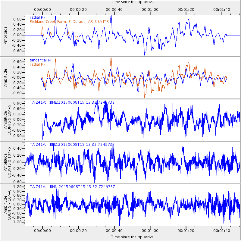
Z41A Richland Creek Farm, El Dorado, AR, USA - Earthquake Result Viewer
*The percent match for this event was below the threshold and hence no stack was calculated.
| Earthquake location: |
Tonga Islands |
| Earthquake latitude/longitude: |
-15.2/-173.1 |
| Earthquake time(UTC): |
2015/06/08 (159) 15:01:03 GMT |
| Earthquake Depth: |
14 km |
| Earthquake Magnitude: |
5.5 MW |
| Earthquake Catalog/Contributor: |
ISC/ISC |
|
| Network: |
TA USArray Transportable Network (new EarthScope stations) |
| Station: |
Z41A Richland Creek Farm, El Dorado, AR, USA |
| Lat/Lon: |
33.26 N/92.80 W |
| Elevation: |
62 m |
|
| Distance: |
90.3 deg |
| Az: |
55.673 deg |
| Baz: |
252.11 deg |
| Ray Param: |
$rayparam |
*The percent match for this event was below the threshold and hence was not used in the summary stack. |
|
| Radial Match: |
47.08061 % |
| Radial Bump: |
400 |
| Transverse Match: |
44.060776 % |
| Transverse Bump: |
400 |
| SOD ConfigId: |
7422571 |
| Insert Time: |
2019-04-19 06:06:33.996 +0000 |
| GWidth: |
2.5 |
| Max Bumps: |
400 |
| Tol: |
0.001 |
|
Signal To Noise
| Channel | StoN | STA | LTA |
| TA:Z41A: :BHZ:20150608T15:13:32.724973Z | 1.0221896 | 1.3785449E-7 | 1.3486195E-7 |
| TA:Z41A: :BHN:20150608T15:13:32.724973Z | 1.0990236 | 2.9690827E-7 | 2.7015642E-7 |
| TA:Z41A: :BHE:20150608T15:13:32.724973Z | 2.491327 | 7.301667E-7 | 2.9308342E-7 |
| Arrivals |
| Ps | |
| PpPs | |
| PsPs/PpSs | |


