You are here: Home > Network List > TA - USArray Transportable Network (new EarthScope stations) Stations List
> Station G59A Clarenceville, QC, USA > Earthquake Result Viewer
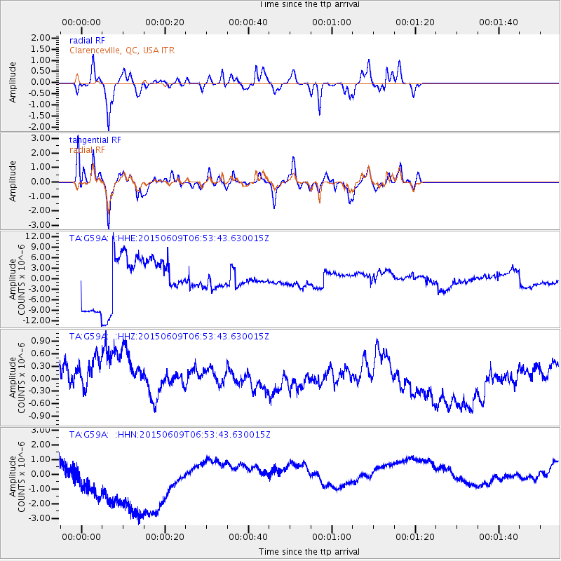
G59A Clarenceville, QC, USA - Earthquake Result Viewer
*The percent match for this event was below the threshold and hence no stack was calculated.
| Earthquake location: |
Southern East Pacific Rise |
| Earthquake latitude/longitude: |
-35.4/-105.8 |
| Earthquake time(UTC): |
2015/06/09 (160) 06:41:38 GMT |
| Earthquake Depth: |
10 km |
| Earthquake Magnitude: |
5.5 MWC, 5.4 MWB, 5.5 MWC |
| Earthquake Catalog/Contributor: |
NEIC PDE/NEIC COMCAT |
|
| Network: |
TA USArray Transportable Network (new EarthScope stations) |
| Station: |
G59A Clarenceville, QC, USA |
| Lat/Lon: |
45.08 N/73.18 W |
| Elevation: |
36 m |
|
| Distance: |
85.4 deg |
| Az: |
22.537 deg |
| Baz: |
206.238 deg |
| Ray Param: |
$rayparam |
*The percent match for this event was below the threshold and hence was not used in the summary stack. |
|
| Radial Match: |
60.631126 % |
| Radial Bump: |
350 |
| Transverse Match: |
44.85415 % |
| Transverse Bump: |
394 |
| SOD ConfigId: |
7422571 |
| Insert Time: |
2019-04-19 06:23:26.066 +0000 |
| GWidth: |
2.5 |
| Max Bumps: |
400 |
| Tol: |
0.001 |
|
Signal To Noise
| Channel | StoN | STA | LTA |
| TA:G59A: :HHZ:20150609T06:53:43.630015Z | 1.6031862 | 9.316361E-7 | 5.8111533E-7 |
| TA:G59A: :HHN:20150609T06:53:43.630015Z | 3.207046 | 3.6982808E-6 | 1.1531736E-6 |
| TA:G59A: :HHE:20150609T06:53:43.630015Z | 0.31955075 | 2.2377637E-6 | 7.0028427E-6 |
| Arrivals |
| Ps | |
| PpPs | |
| PsPs/PpSs | |


