You are here: Home > Network List > AK - Alaska Regional Network Stations List
> Station CUT Chulitna, AK, USA > Earthquake Result Viewer
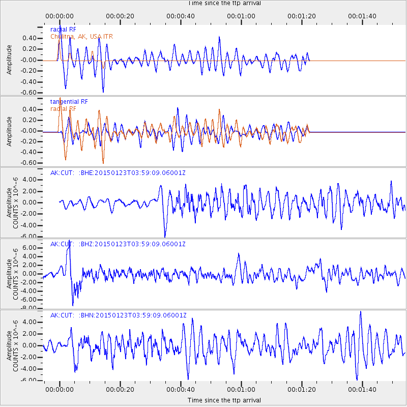
CUT Chulitna, AK, USA - Earthquake Result Viewer

| Earthquake location: |
Vanuatu Islands |
| Earthquake latitude/longitude: |
-17.0/168.5 |
| Earthquake time(UTC): |
2015/01/23 (023) 03:47:27 GMT |
| Earthquake Depth: |
218 km |
| Earthquake Magnitude: |
6.8 MWP, 6.9 MI, 7.0 MI |
| Earthquake Catalog/Contributor: |
NEIC PDE/NEIC COMCAT |
|
| Network: |
AK Alaska Regional Network |
| Station: |
CUT Chulitna, AK, USA |
| Lat/Lon: |
62.41 N/150.26 W |
| Elevation: |
574 m |
|
| Distance: |
85.5 deg |
| Az: |
17.92 deg |
| Baz: |
219.218 deg |
| Ray Param: |
0.044184804 |
| Estimated Moho Depth: |
24.75 km |
| Estimated Crust Vp/Vs: |
1.91 |
| Assumed Crust Vp: |
6.438 km/s |
| Estimated Crust Vs: |
3.362 km/s |
| Estimated Crust Poisson's Ratio: |
0.31 |
|
| Radial Match: |
84.20738 % |
| Radial Bump: |
386 |
| Transverse Match: |
73.68664 % |
| Transverse Bump: |
374 |
| SOD ConfigId: |
837871 |
| Insert Time: |
2015-02-06 03:54:57.952 +0000 |
| GWidth: |
2.5 |
| Max Bumps: |
400 |
| Tol: |
0.001 |
|
Signal To Noise
| Channel | StoN | STA | LTA |
| AK:CUT: :BHZ:20150123T03:59:09.06001Z | 9.216547 | 3.6019326E-6 | 3.9081152E-7 |
| AK:CUT: :BHN:20150123T03:59:09.06001Z | 1.6586728 | 1.0318652E-6 | 6.221029E-7 |
| AK:CUT: :BHE:20150123T03:59:09.06001Z | 3.0335927 | 1.7631086E-6 | 5.811949E-7 |
| Arrivals |
| Ps | 3.6 SECOND |
| PpPs | 11 SECOND |
| PsPs/PpSs | 15 SECOND |


