
CTAO Charters Towers, Australia - Earthquake Result Viewer
| ||||||||||||||||||
| ||||||||||||||||||
| ||||||||||||||||||
|
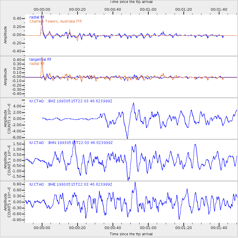
Signal To Noise
| Channel | StoN | STA | LTA |
| IU:CTAO: :BHN:19930515T22:03:46.623999Z | 2.6791856 | 2.7698317E-7 | 1.0338335E-7 |
| IU:CTAO: :BHE:19930515T22:03:46.623999Z | 1.2927476 | 1.5856904E-7 | 1.2266048E-7 |
| IU:CTAO: :BHZ:19930515T22:03:46.623999Z | 4.4489403 | 8.147222E-7 | 1.8312726E-7 |
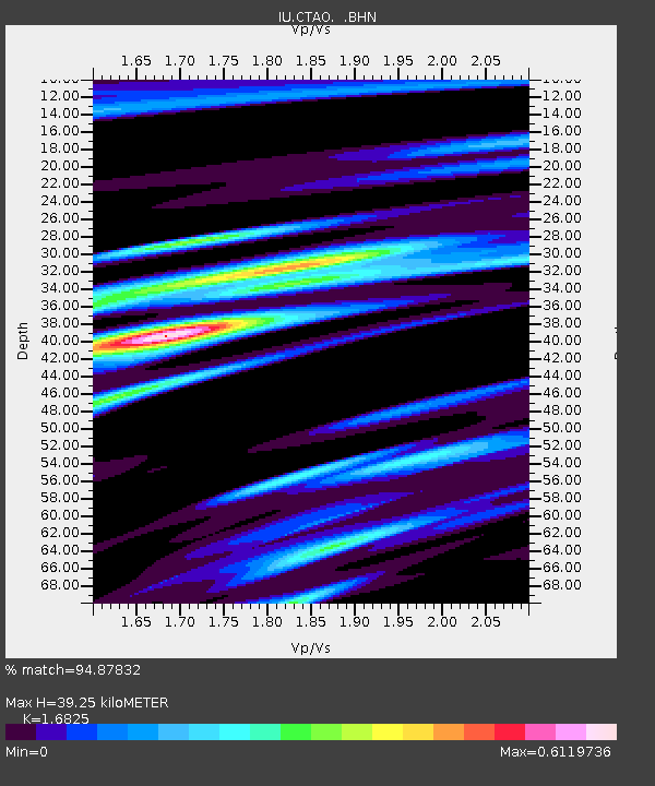
| Arrivals | |
| Ps | 4.2 SECOND |
| PpPs | 16 SECOND |
| PsPs/PpSs | 20 SECOND |

