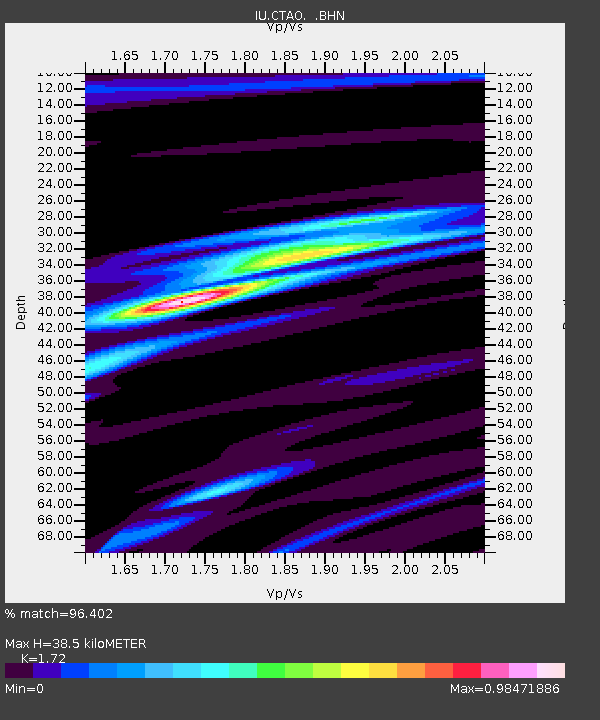
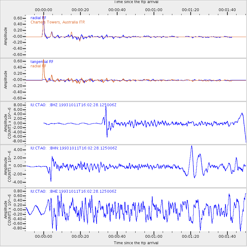
CTAO Charters Towers, Australia - Earthquake Result Viewer

Earthquake location: Southeast Of Honshu, Japan
Earthquake latitude/longitude: 32.0/137.9
Earthquake time(UTC): 1993/10/11 (284) 15:54:22 GMT
Earthquake Depth: 365 km
Earthquake Magnitude: 6.5 MB, 6.8 UNKNOWN, 6.9 MW
Earthquake Catalog/Contributor: WHDF/NEIC
Network: IU Global Seismograph Network (GSN - IRIS/USGS)
Station: CTAO Charters Towers, Australia
Lat/Lon: 20.09 S/146.25 E
Elevation: 357 m
Distance: 52.4 deg
Az: 170.02 deg
Baz: 350.987 deg
Ray Param: 0.0653404
Estimated Moho Depth: 38.5 km
Estimated Crust Vp/Vs: 1.72
Assumed Crust Vp: 6.522 km/s
Estimated Crust Vs: 3.792 km/s
Estimated Crust Poisson's Ratio: 0.24
Radial Match: 96.402 %
Radial Bump: 240
Transverse Match: 67.616844 %
Transverse Bump: 400
SOD ConfigId: 16938
Insert Time: 2010-03-03 14:20:14.379 +0000
GWidth: 2.5
Max Bumps: 400
Tol: 0.001

Signal To Noise

ChannelStoNSTALTA
IU:CTAO: :BHN:19931011T16:02:28.125006Z15.2530051.3030733E-68.543059E-8
IU:CTAO: :BHE:19931011T16:02:28.125006Z3.3876942.9934486E-78.836243E-8
IU:CTAO: :BHZ:19931011T16:02:28.125006Z14.5404992.7512326E-61.892117E-7
Arrivals
Ps4.5 SECOND
PpPs15 SECOND
PsPs/PpSs20 SECOND