You are here: Home > Network List > UW - Pacific Northwest Regional Seismic Network Stations List
> Station LEBA Lebam, WA, USA > Earthquake Result Viewer
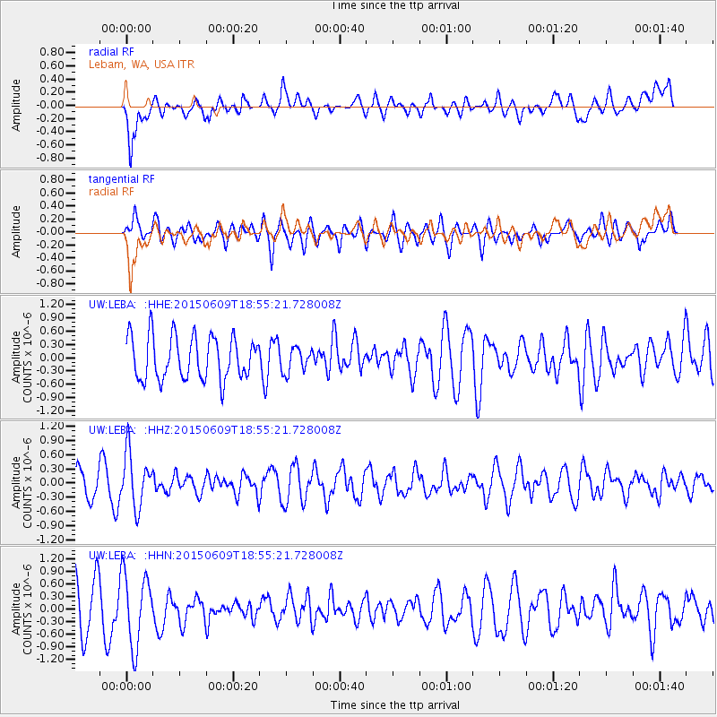
LEBA Lebam, WA, USA - Earthquake Result Viewer
*The percent match for this event was below the threshold and hence no stack was calculated.
| Earthquake location: |
South Of Fiji Islands |
| Earthquake latitude/longitude: |
-24.0/-176.3 |
| Earthquake time(UTC): |
2015/06/09 (160) 18:43:27 GMT |
| Earthquake Depth: |
82 km |
| Earthquake Magnitude: |
5.0 mb |
| Earthquake Catalog/Contributor: |
ISC/ISC |
|
| Network: |
UW Pacific Northwest Regional Seismic Network |
| Station: |
LEBA Lebam, WA, USA |
| Lat/Lon: |
46.55 N/123.56 W |
| Elevation: |
73 m |
|
| Distance: |
84.9 deg |
| Az: |
33.48 deg |
| Baz: |
226.954 deg |
| Ray Param: |
$rayparam |
*The percent match for this event was below the threshold and hence was not used in the summary stack. |
|
| Radial Match: |
58.820087 % |
| Radial Bump: |
400 |
| Transverse Match: |
67.93398 % |
| Transverse Bump: |
400 |
| SOD ConfigId: |
7422571 |
| Insert Time: |
2019-04-19 06:30:12.399 +0000 |
| GWidth: |
2.5 |
| Max Bumps: |
400 |
| Tol: |
0.001 |
|
Signal To Noise
| Channel | StoN | STA | LTA |
| UW:LEBA: :HHZ:20150609T18:55:21.728008Z | 1.5820687 | 5.7729665E-7 | 3.6489988E-7 |
| UW:LEBA: :HHN:20150609T18:55:21.728008Z | 1.5318129 | 8.609579E-7 | 5.620516E-7 |
| UW:LEBA: :HHE:20150609T18:55:21.728008Z | 0.5701021 | 2.782123E-7 | 4.8800433E-7 |
| Arrivals |
| Ps | |
| PpPs | |
| PsPs/PpSs | |


