CTAO Charters Towers, Australia - Earthquake Result Viewer
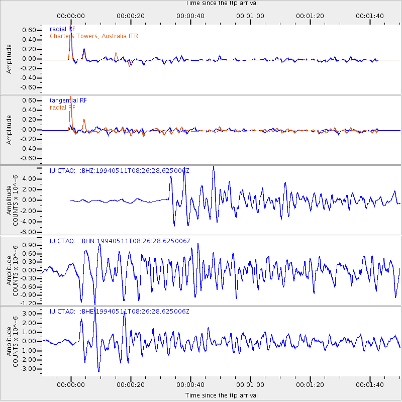
Earthquake location: Southern Sumatra, Indonesia
Earthquake latitude/longitude: -2.0/99.8
Earthquake time(UTC): 1994/05/11 (131) 08:18:16 GMT
Earthquake Depth: 28 km
Earthquake Magnitude: 6.0 MB, 6.3 MS, 6.0 UNKNOWN, 6.3 MW
Earthquake Catalog/Contributor: WHDF/NEIC
Network: IU Global Seismograph Network (GSN - IRIS/USGS)
Station: CTAO Charters Towers, Australia
Lat/Lon: 20.09 S/146.25 E
Elevation: 357 m
Distance: 48.8 deg
Az: 115.079 deg
Baz: 285.622 deg
Ray Param: 0.06908219
Estimated Moho Depth: 25.25 km
Estimated Crust Vp/Vs: 2.09
Assumed Crust Vp: 6.522 km/s
Estimated Crust Vs: 3.124 km/s
Estimated Crust Poisson's Ratio: 0.35
Radial Match: 94.85001 %
Radial Bump: 281
Transverse Match: 84.70448 %
Transverse Bump: 400
SOD ConfigId: 16938
Insert Time: 2010-03-03 14:20:56.478 +0000
GWidth: 2.5
Max Bumps: 400
Tol: 0.001

Signal To Noise

ChannelStoNSTALTA
IU:CTAO: :BHN:19940511T08:26:28.625006Z6.8088874.7576896E-76.98747E-8
IU:CTAO: :BHE:19940511T08:26:28.625006Z7.6686571.0699464E-61.3952202E-7
IU:CTAO: :BHZ:19940511T08:26:28.625006Z11.0291512.0407663E-61.8503387E-7
Arrivals
Ps4.4 SECOND
PpPs11 SECOND
PsPs/PpSs16 SECOND