CTAO Charters Towers, Australia - Earthquake Result Viewer
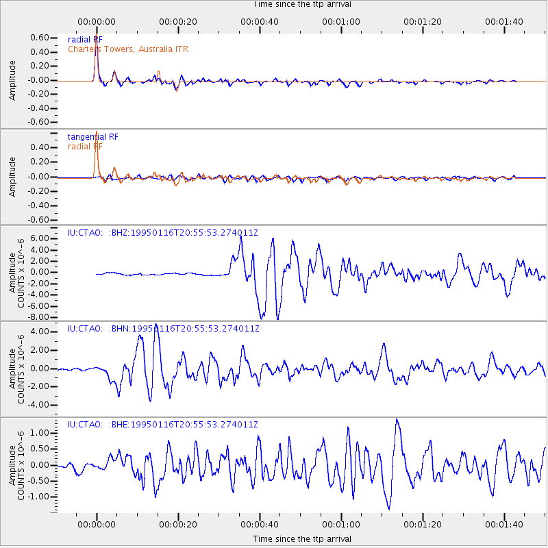
Earthquake location: Near S. Coast Of Western Honshu
Earthquake latitude/longitude: 34.5/135.0
Earthquake time(UTC): 1995/01/16 (016) 20:46:51 GMT
Earthquake Depth: 16 km
Earthquake Magnitude: 6.4 MB, 6.8 MS, 6.5 UNKNOWN, 6.9 MW
Earthquake Catalog/Contributor: WHDF/NEIC
Network: IU Global Seismograph Network (GSN - IRIS/USGS)
Station: CTAO Charters Towers, Australia
Lat/Lon: 20.09 S/146.25 E
Elevation: 357 m
Distance: 55.4 deg
Az: 167.122 deg
Baz: 348.713 deg
Ray Param: 0.06481743
Estimated Moho Depth: 38.75 km
Estimated Crust Vp/Vs: 1.71
Assumed Crust Vp: 6.522 km/s
Estimated Crust Vs: 3.819 km/s
Estimated Crust Poisson's Ratio: 0.24
Radial Match: 97.44085 %
Radial Bump: 277
Transverse Match: 83.87802 %
Transverse Bump: 400
SOD ConfigId: 6273
Insert Time: 2010-03-03 14:22:13.029 +0000
GWidth: 2.5
Max Bumps: 400
Tol: 0.001

Signal To Noise

ChannelStoNSTALTA
IU:CTAO: :BHN:19950116T20:55:53.274011Z9.4165048.1666997E-78.672752E-8
IU:CTAO: :BHE:19950116T20:55:53.274011Z2.40130951.7261961E-77.1885616E-8
IU:CTAO: :BHZ:19950116T20:55:53.274011Z11.428491.6704155E-61.461624E-7
Arrivals
Ps4.4 SECOND
PpPs15 SECOND
PsPs/PpSs20 SECOND