CTAO Charters Towers, Australia - Earthquake Result Viewer
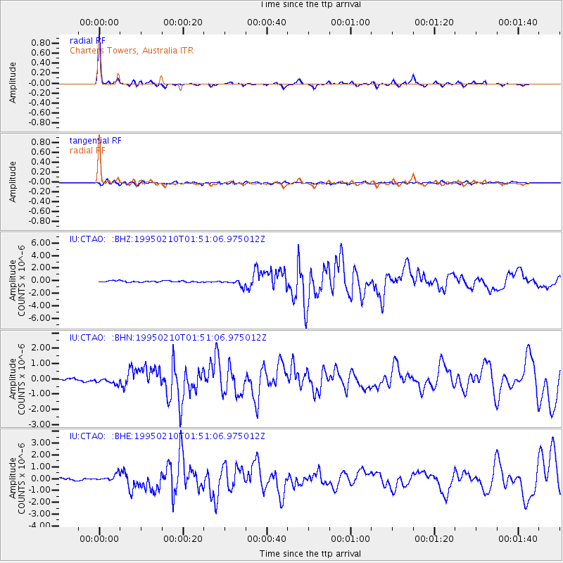
Earthquake location: Off E. Coast Of N. Island, N.Z.
Earthquake latitude/longitude: -38.0/178.5
Earthquake time(UTC): 1995/02/10 (041) 01:45:04 GMT
Earthquake Depth: 33 km
Earthquake Magnitude: 5.8 MB, 6.4 MS, 6.5 UNKNOWN, 6.3 ML
Earthquake Catalog/Contributor: WHDF/NEIC
Network: IU Global Seismograph Network (GSN - IRIS/USGS)
Station: CTAO Charters Towers, Australia
Lat/Lon: 20.09 S/146.25 E
Elevation: 357 m
Distance: 33.1 deg
Az: 293.446 deg
Baz: 129.515 deg
Ray Param: 0.07830701
Estimated Moho Depth: 26.25 km
Estimated Crust Vp/Vs: 2.04
Assumed Crust Vp: 6.522 km/s
Estimated Crust Vs: 3.193 km/s
Estimated Crust Poisson's Ratio: 0.34
Radial Match: 95.08364 %
Radial Bump: 234
Transverse Match: 72.59898 %
Transverse Bump: 400
SOD ConfigId: 6273
Insert Time: 2010-03-03 14:22:21.227 +0000
GWidth: 2.5
Max Bumps: 400
Tol: 0.001

Signal To Noise

ChannelStoNSTALTA
IU:CTAO: :BHN:19950210T01:51:06.975012Z2.87941432.1451605E-77.4499894E-8
IU:CTAO: :BHE:19950210T01:51:06.975012Z3.68108493.111987E-78.453994E-8
IU:CTAO: :BHZ:19950210T01:51:06.975012Z4.6390165.295502E-71.1415141E-7
Arrivals
Ps4.5 SECOND
PpPs11 SECOND
PsPs/PpSs16 SECOND