You are here: Home > Network List > TA - USArray Transportable Network (new EarthScope stations) Stations List
> Station A04D Lummi Island, WA, USA > Earthquake Result Viewer
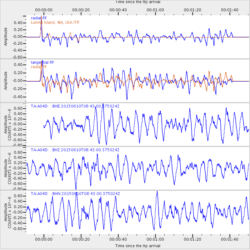
A04D Lummi Island, WA, USA - Earthquake Result Viewer
*The percent match for this event was below the threshold and hence no stack was calculated.
| Earthquake location: |
Off East Coast Of Honshu, Japan |
| Earthquake latitude/longitude: |
39.6/143.4 |
| Earthquake time(UTC): |
2015/06/10 (161) 08:33:02 GMT |
| Earthquake Depth: |
26 km |
| Earthquake Magnitude: |
5.5 MB |
| Earthquake Catalog/Contributor: |
NEIC PDE/NEIC ALERT |
|
| Network: |
TA USArray Transportable Network (new EarthScope stations) |
| Station: |
A04D Lummi Island, WA, USA |
| Lat/Lon: |
48.72 N/122.71 W |
| Elevation: |
13 m |
|
| Distance: |
63.8 deg |
| Az: |
47.402 deg |
| Baz: |
300.873 deg |
| Ray Param: |
$rayparam |
*The percent match for this event was below the threshold and hence was not used in the summary stack. |
|
| Radial Match: |
45.388016 % |
| Radial Bump: |
400 |
| Transverse Match: |
54.108223 % |
| Transverse Bump: |
400 |
| SOD ConfigId: |
7422571 |
| Insert Time: |
2019-04-19 06:44:37.248 +0000 |
| GWidth: |
2.5 |
| Max Bumps: |
400 |
| Tol: |
0.001 |
|
Signal To Noise
| Channel | StoN | STA | LTA |
| TA:A04D: :BHZ:20150610T08:43:00.375024Z | 1.1614252 | 1.5088365E-7 | 1.299125E-7 |
| TA:A04D: :BHN:20150610T08:43:00.375024Z | 0.9194847 | 2.7728055E-7 | 3.0156082E-7 |
| TA:A04D: :BHE:20150610T08:43:00.375024Z | 2.3325634 | 4.3456043E-7 | 1.8630166E-7 |
| Arrivals |
| Ps | |
| PpPs | |
| PsPs/PpSs | |


