You are here: Home > Network List > TA - USArray Transportable Network (new EarthScope stations) Stations List
> Station M54A Oil Creek State Park, Oil City, PA, USA > Earthquake Result Viewer
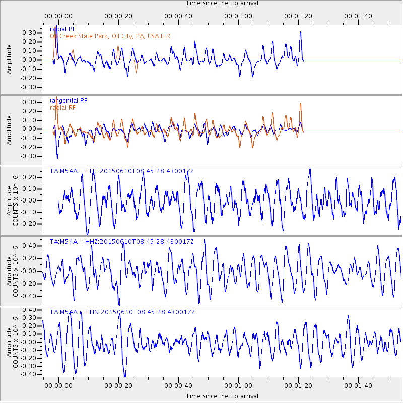
M54A Oil Creek State Park, Oil City, PA, USA - Earthquake Result Viewer
*The percent match for this event was below the threshold and hence no stack was calculated.
| Earthquake location: |
Off East Coast Of Honshu, Japan |
| Earthquake latitude/longitude: |
39.6/143.4 |
| Earthquake time(UTC): |
2015/06/10 (161) 08:33:02 GMT |
| Earthquake Depth: |
26 km |
| Earthquake Magnitude: |
5.5 MB |
| Earthquake Catalog/Contributor: |
NEIC PDE/NEIC ALERT |
|
| Network: |
TA USArray Transportable Network (new EarthScope stations) |
| Station: |
M54A Oil Creek State Park, Oil City, PA, USA |
| Lat/Lon: |
41.51 N/79.66 W |
| Elevation: |
488 m |
|
| Distance: |
90.3 deg |
| Az: |
30.826 deg |
| Baz: |
328.209 deg |
| Ray Param: |
$rayparam |
*The percent match for this event was below the threshold and hence was not used in the summary stack. |
|
| Radial Match: |
61.574947 % |
| Radial Bump: |
400 |
| Transverse Match: |
66.331726 % |
| Transverse Bump: |
400 |
| SOD ConfigId: |
7422571 |
| Insert Time: |
2019-04-19 06:45:03.763 +0000 |
| GWidth: |
2.5 |
| Max Bumps: |
400 |
| Tol: |
0.001 |
|
Signal To Noise
| Channel | StoN | STA | LTA |
| TA:M54A: :HHZ:20150610T08:45:28.430017Z | 0.91816837 | 1.0056642E-7 | 1.0952938E-7 |
| TA:M54A: :HHN:20150610T08:45:28.430017Z | 3.0142848 | 2.3228225E-7 | 7.7060484E-8 |
| TA:M54A: :HHE:20150610T08:45:28.430017Z | 0.60071397 | 7.050172E-8 | 1.1736321E-7 |
| Arrivals |
| Ps | |
| PpPs | |
| PsPs/PpSs | |


