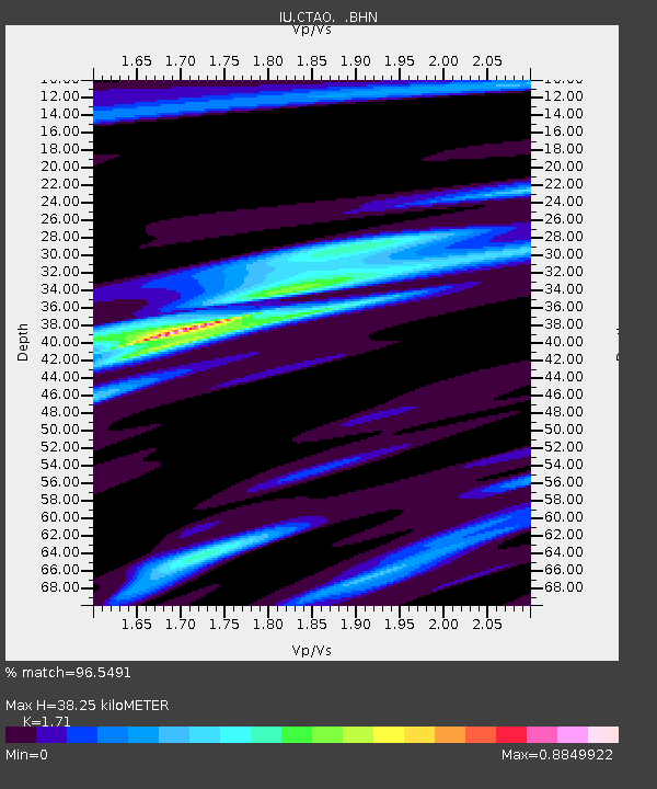
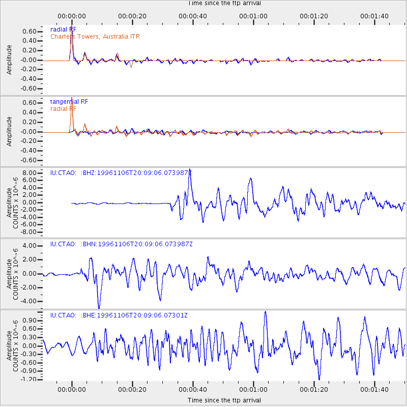
CTAO Charters Towers, Australia - Earthquake Result Viewer

Earthquake location: Bonin Islands, Japan Region
Earthquake latitude/longitude: 28.0/143.5
Earthquake time(UTC): 1996/11/06 (311) 20:00:58 GMT
Earthquake Depth: 9.0 km
Earthquake Magnitude: 6.4 MB, 6.5 MS, 6.6 UNKNOWN, 6.4 ME
Earthquake Catalog/Contributor: WHDF/NEIC
Network: IU Global Seismograph Network (GSN - IRIS/USGS)
Station: CTAO Charters Towers, Australia
Lat/Lon: 20.09 S/146.25 E
Elevation: 357 m
Distance: 47.9 deg
Az: 176.557 deg
Baz: 356.761 deg
Ray Param: 0.06971553
Estimated Moho Depth: 38.25 km
Estimated Crust Vp/Vs: 1.71
Assumed Crust Vp: 6.522 km/s
Estimated Crust Vs: 3.814 km/s
Estimated Crust Poisson's Ratio: 0.24
Radial Match: 96.5491 %
Radial Bump: 238
Transverse Match: 72.72112 %
Transverse Bump: 400
SOD ConfigId: 6273
Insert Time: 2010-03-03 14:22:57.580 +0000
GWidth: 2.5
Max Bumps: 400
Tol: 0.001

Signal To Noise

ChannelStoNSTALTA
IU:CTAO: :BHN:19961106T20:09:06.073987Z2.04527932.384933E-71.16606714E-7
IU:CTAO: :BHE:19961106T20:09:06.07301Z1.42722992.2576273E-71.5818246E-7
IU:CTAO: :BHZ:19961106T20:09:06.073987Z5.5542696.0653514E-71.0920162E-7
Arrivals
Ps4.4 SECOND
PpPs15 SECOND
PsPs/PpSs19 SECOND