You are here: Home > Network List > GS - US Geological Survey Networks Stations List
> Station KAN13 Rinehart Farm > Earthquake Result Viewer
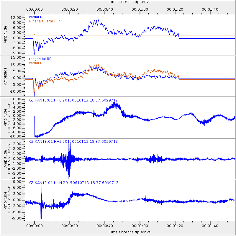
KAN13 Rinehart Farm - Earthquake Result Viewer
*The percent match for this event was below the threshold and hence no stack was calculated.
| Earthquake location: |
Tonga Islands Region |
| Earthquake latitude/longitude: |
-23.6/-175.9 |
| Earthquake time(UTC): |
2015/06/10 (161) 13:05:48 GMT |
| Earthquake Depth: |
33 km |
| Earthquake Magnitude: |
4.7 mb |
| Earthquake Catalog/Contributor: |
ISC/ISC |
|
| Network: |
GS US Geological Survey Networks |
| Station: |
KAN13 Rinehart Farm |
| Lat/Lon: |
37.01 N/97.48 W |
| Elevation: |
340 m |
|
| Distance: |
95.3 deg |
| Az: |
51.954 deg |
| Baz: |
244.489 deg |
| Ray Param: |
$rayparam |
*The percent match for this event was below the threshold and hence was not used in the summary stack. |
|
| Radial Match: |
43.82748 % |
| Radial Bump: |
400 |
| Transverse Match: |
58.064728 % |
| Transverse Bump: |
400 |
| SOD ConfigId: |
7422571 |
| Insert Time: |
2019-04-19 06:49:38.660 +0000 |
| GWidth: |
2.5 |
| Max Bumps: |
400 |
| Tol: |
0.001 |
|
Signal To Noise
| Channel | StoN | STA | LTA |
| GS:KAN13:01:HHZ:20150610T13:18:37.609971Z | 0.9663104 | 2.4204712E-7 | 2.504859E-7 |
| GS:KAN13:01:HHN:20150610T13:18:37.609971Z | 4.037916 | 2.601202E-6 | 6.441942E-7 |
| GS:KAN13:01:HHE:20150610T13:18:37.609971Z | 1.500125 | 5.922832E-6 | 3.9482256E-6 |
| Arrivals |
| Ps | |
| PpPs | |
| PsPs/PpSs | |


