You are here: Home > Network List > TA - USArray Transportable Network (new EarthScope stations) Stations List
> Station J01E Myrtle Point, OR, USA > Earthquake Result Viewer
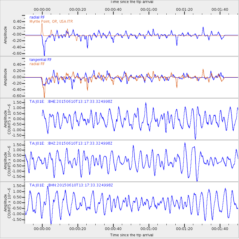
J01E Myrtle Point, OR, USA - Earthquake Result Viewer
*The percent match for this event was below the threshold and hence no stack was calculated.
| Earthquake location: |
Tonga Islands Region |
| Earthquake latitude/longitude: |
-23.6/-175.9 |
| Earthquake time(UTC): |
2015/06/10 (161) 13:05:48 GMT |
| Earthquake Depth: |
33 km |
| Earthquake Magnitude: |
4.7 mb |
| Earthquake Catalog/Contributor: |
ISC/ISC |
|
| Network: |
TA USArray Transportable Network (new EarthScope stations) |
| Station: |
J01E Myrtle Point, OR, USA |
| Lat/Lon: |
43.16 N/123.93 W |
| Elevation: |
128 m |
|
| Distance: |
81.8 deg |
| Az: |
35.62 deg |
| Baz: |
226.897 deg |
| Ray Param: |
$rayparam |
*The percent match for this event was below the threshold and hence was not used in the summary stack. |
|
| Radial Match: |
60.07371 % |
| Radial Bump: |
317 |
| Transverse Match: |
64.88748 % |
| Transverse Bump: |
400 |
| SOD ConfigId: |
7422571 |
| Insert Time: |
2019-04-19 06:51:23.744 +0000 |
| GWidth: |
2.5 |
| Max Bumps: |
400 |
| Tol: |
0.001 |
|
Signal To Noise
| Channel | StoN | STA | LTA |
| TA:J01E: :BHZ:20150610T13:17:33.324998Z | 0.8615452 | 4.1073844E-7 | 4.7674627E-7 |
| TA:J01E: :BHN:20150610T13:17:33.324998Z | 1.7097526 | 8.9398634E-7 | 5.228747E-7 |
| TA:J01E: :BHE:20150610T13:17:33.324998Z | 0.8424572 | 3.9322785E-7 | 4.6676303E-7 |
| Arrivals |
| Ps | |
| PpPs | |
| PsPs/PpSs | |


