CTAO Charters Towers, Australia - Earthquake Result Viewer
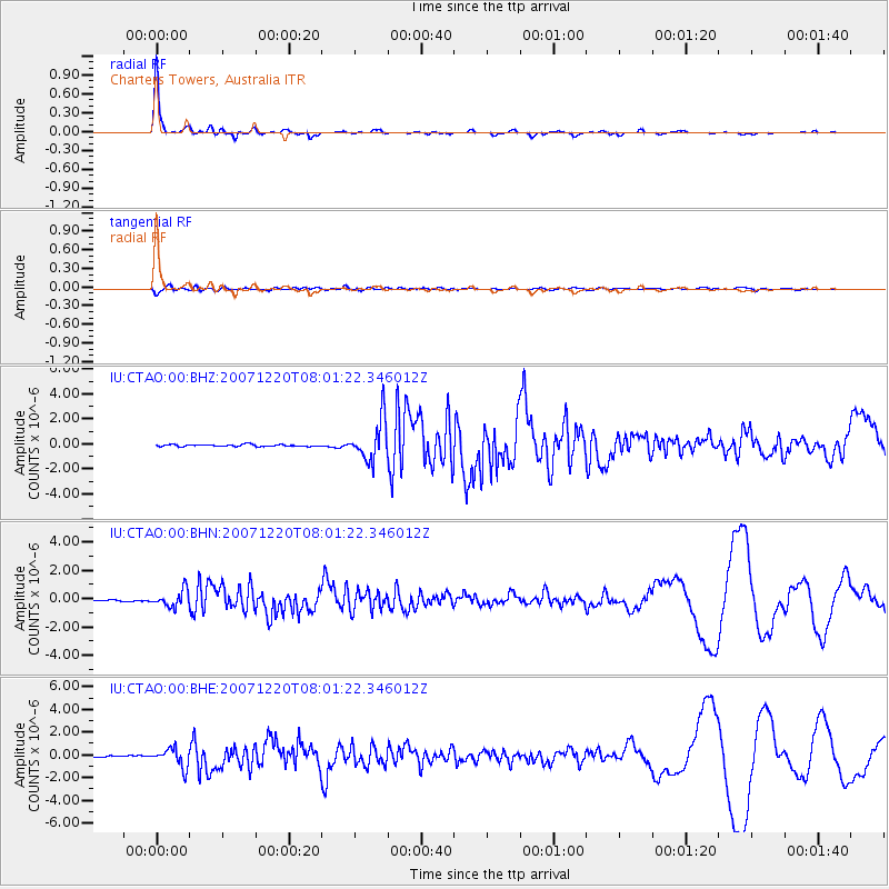
Earthquake location: Off E. Coast Of N. Island, N.Z.
Earthquake latitude/longitude: -39.0/178.3
Earthquake time(UTC): 2007/12/20 (354) 07:55:15 GMT
Earthquake Depth: 20 km
Earthquake Magnitude: 6.3 MB, 6.5 MS, 6.6 MW, 6.5 MW
Earthquake Catalog/Contributor: WHDF/NEIC
Network: IU Global Seismograph Network (GSN - IRIS/USGS)
Station: CTAO Charters Towers, Australia
Lat/Lon: 20.09 S/146.25 E
Elevation: 357 m
Distance: 33.4 deg
Az: 295.095 deg
Baz: 131.353 deg
Ray Param: 0.0782017
Estimated Moho Depth: 50.75 km
Estimated Crust Vp/Vs: 1.60
Assumed Crust Vp: 6.522 km/s
Estimated Crust Vs: 4.076 km/s
Estimated Crust Poisson's Ratio: 0.18
Radial Match: 95.158806 %
Radial Bump: 198
Transverse Match: 81.48861 %
Transverse Bump: 400
SOD ConfigId: 2564
Insert Time: 2010-03-03 14:24:52.507 +0000
GWidth: 2.5
Max Bumps: 400
Tol: 0.001

Signal To Noise

ChannelStoNSTALTA
IU:CTAO:00:BHN:20071220T08:01:22.346012Z12.2798045.7340446E-74.6694918E-8
IU:CTAO:00:BHE:20071220T08:01:22.346012Z11.5718118.2415517E-77.122094E-8
IU:CTAO:00:BHZ:20071220T08:01:22.346012Z21.4093231.6293426E-67.610435E-8
Arrivals
Ps5.1 SECOND
PpPs18 SECOND
PsPs/PpSs24 SECOND