You are here: Home > Network List > US - United States National Seismic Network Stations List
> Station MSO Missoula, Montana, USA > Earthquake Result Viewer
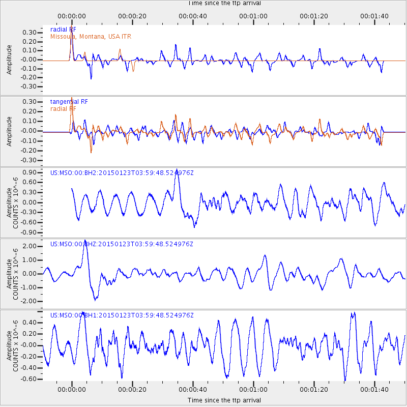
MSO Missoula, Montana, USA - Earthquake Result Viewer
*The percent match for this event was below the threshold and hence no stack was calculated.
| Earthquake location: |
Vanuatu Islands |
| Earthquake latitude/longitude: |
-17.0/168.5 |
| Earthquake time(UTC): |
2015/01/23 (023) 03:47:27 GMT |
| Earthquake Depth: |
218 km |
| Earthquake Magnitude: |
6.8 MWP, 6.9 MI, 7.0 MI |
| Earthquake Catalog/Contributor: |
NEIC PDE/NEIC COMCAT |
|
| Network: |
US United States National Seismic Network |
| Station: |
MSO Missoula, Montana, USA |
| Lat/Lon: |
46.83 N/113.94 W |
| Elevation: |
1264 m |
|
| Distance: |
94.0 deg |
| Az: |
42.224 deg |
| Baz: |
249.476 deg |
| Ray Param: |
$rayparam |
*The percent match for this event was below the threshold and hence was not used in the summary stack. |
|
| Radial Match: |
62.049812 % |
| Radial Bump: |
329 |
| Transverse Match: |
55.089916 % |
| Transverse Bump: |
400 |
| SOD ConfigId: |
837871 |
| Insert Time: |
2015-02-06 04:03:25.110 +0000 |
| GWidth: |
2.5 |
| Max Bumps: |
400 |
| Tol: |
0.001 |
|
Signal To Noise
| Channel | StoN | STA | LTA |
| US:MSO:00:BHZ:20150123T03:59:48.524976Z | 3.7901866 | 1.1310553E-6 | 2.984168E-7 |
| US:MSO:00:BH1:20150123T03:59:48.524976Z | 1.7607882 | 3.4178947E-7 | 1.9411164E-7 |
| US:MSO:00:BH2:20150123T03:59:48.524976Z | 1.8135678 | 4.4356747E-7 | 2.445828E-7 |
| Arrivals |
| Ps | |
| PpPs | |
| PsPs/PpSs | |


