You are here: Home > Network List > AV - Alaska Volcano Observatory Stations List
> Station MAPS Pakushin Southeast, Makushin Volcano, Alaska > Earthquake Result Viewer
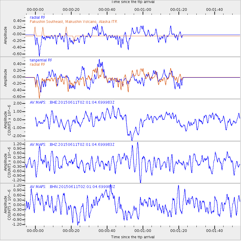
MAPS Pakushin Southeast, Makushin Volcano, Alaska - Earthquake Result Viewer
*The percent match for this event was below the threshold and hence no stack was calculated.
| Earthquake location: |
Kermadec Islands Region |
| Earthquake latitude/longitude: |
-31.5/179.9 |
| Earthquake time(UTC): |
2015/06/11 (162) 01:49:45 GMT |
| Earthquake Depth: |
450 km |
| Earthquake Magnitude: |
4.5 mb |
| Earthquake Catalog/Contributor: |
ISC/ISC |
|
| Network: |
AV Alaska Volcano Observatory |
| Station: |
MAPS Pakushin Southeast, Makushin Volcano, Alaska |
| Lat/Lon: |
53.81 N/166.94 W |
| Elevation: |
333 m |
|
| Distance: |
85.7 deg |
| Az: |
7.762 deg |
| Baz: |
191.219 deg |
| Ray Param: |
$rayparam |
*The percent match for this event was below the threshold and hence was not used in the summary stack. |
|
| Radial Match: |
67.68923 % |
| Radial Bump: |
400 |
| Transverse Match: |
52.659237 % |
| Transverse Bump: |
400 |
| SOD ConfigId: |
7422571 |
| Insert Time: |
2019-04-19 07:10:32.545 +0000 |
| GWidth: |
2.5 |
| Max Bumps: |
400 |
| Tol: |
0.001 |
|
Signal To Noise
| Channel | StoN | STA | LTA |
| AV:MAPS: :BHZ:20150611T02:01:04.699983Z | 1.4208891 | 5.0881926E-7 | 3.5809921E-7 |
| AV:MAPS: :BHN:20150611T02:01:04.699983Z | 1.3926628 | 5.022035E-7 | 3.6060666E-7 |
| AV:MAPS: :BHE:20150611T02:01:04.699983Z | 1.1792146 | 5.9349736E-7 | 5.0329885E-7 |
| Arrivals |
| Ps | |
| PpPs | |
| PsPs/PpSs | |


