You are here: Home > Network List > GS - US Geological Survey Networks Stations List
> Station KAN10 Keim Farm > Earthquake Result Viewer
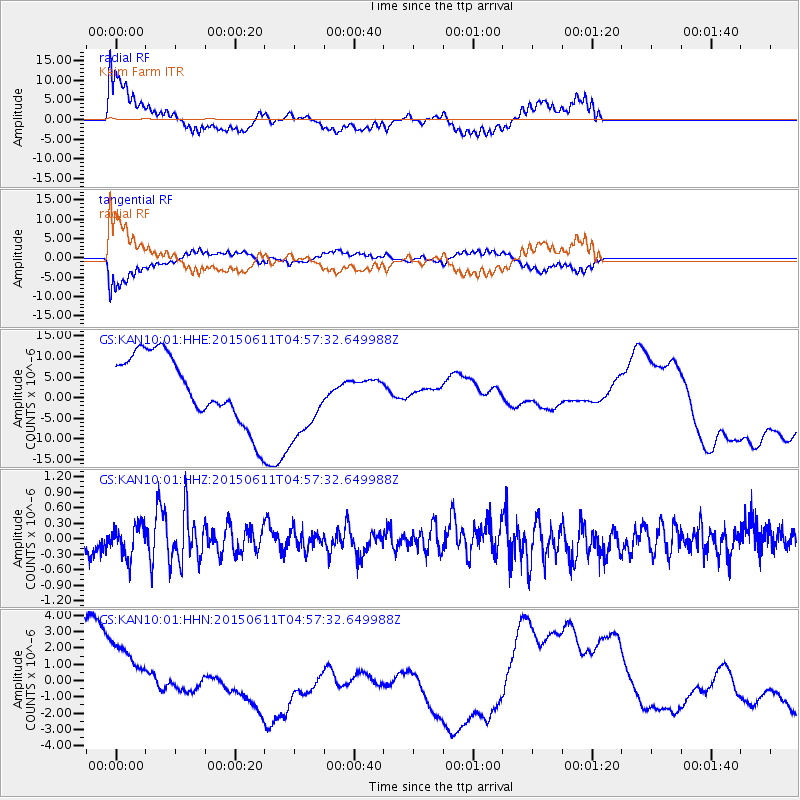
KAN10 Keim Farm - Earthquake Result Viewer
*The percent match for this event was below the threshold and hence no stack was calculated.
| Earthquake location: |
Off East Coast Of Honshu, Japan |
| Earthquake latitude/longitude: |
39.6/143.4 |
| Earthquake time(UTC): |
2015/06/11 (162) 04:45:30 GMT |
| Earthquake Depth: |
13 km |
| Earthquake Magnitude: |
5.7 MB |
| Earthquake Catalog/Contributor: |
NEIC PDE/NEIC ALERT |
|
| Network: |
GS US Geological Survey Networks |
| Station: |
KAN10 Keim Farm |
| Lat/Lon: |
37.12 N/98.10 W |
| Elevation: |
417 m |
|
| Distance: |
85.0 deg |
| Az: |
44.852 deg |
| Baz: |
317.042 deg |
| Ray Param: |
$rayparam |
*The percent match for this event was below the threshold and hence was not used in the summary stack. |
|
| Radial Match: |
79.19183 % |
| Radial Bump: |
400 |
| Transverse Match: |
79.03547 % |
| Transverse Bump: |
400 |
| SOD ConfigId: |
7422571 |
| Insert Time: |
2019-04-19 07:18:55.317 +0000 |
| GWidth: |
2.5 |
| Max Bumps: |
400 |
| Tol: |
0.001 |
|
Signal To Noise
| Channel | StoN | STA | LTA |
| GS:KAN10:01:HHZ:20150611T04:57:32.649988Z | 1.215258 | 2.9985793E-7 | 2.4674426E-7 |
| GS:KAN10:01:HHN:20150611T04:57:32.649988Z | 1.0967911 | 2.3614573E-6 | 2.1530602E-6 |
| GS:KAN10:01:HHE:20150611T04:57:32.649988Z | 0.8612243 | 7.6267006E-6 | 8.85565E-6 |
| Arrivals |
| Ps | |
| PpPs | |
| PsPs/PpSs | |


