You are here: Home > Network List > IU - Global Seismograph Network (GSN - IRIS/USGS) Stations List
> Station CTAO Charters Towers, Australia > Earthquake Result Viewer
CTAO Charters Towers, Australia - Earthquake Result Viewer

| Earthquake location: |
Qinghai, China |
| Earthquake latitude/longitude: |
35.9/90.5 |
| Earthquake time(UTC): |
2001/11/14 (318) 09:26:10 GMT |
| Earthquake Depth: |
10 km |
| Earthquake Magnitude: |
6.1 MB, 8.0 MS, 7.8 MW, 7.7 MW |
| Earthquake Catalog/Contributor: |
WHDF/NEIC |
|
| Network: |
IU Global Seismograph Network (GSN - IRIS/USGS) |
| Station: |
CTAO Charters Towers, Australia |
| Lat/Lon: |
20.09 S/146.25 E |
| Elevation: |
357 m |
|
| Distance: |
76.7 deg |
| Az: |
127.061 deg |
| Baz: |
316.455 deg |
| Ray Param: |
0.050819874 |
| Estimated Moho Depth: |
42.0 km |
| Estimated Crust Vp/Vs: |
1.67 |
| Assumed Crust Vp: |
6.522 km/s |
| Estimated Crust Vs: |
3.911 km/s |
| Estimated Crust Poisson's Ratio: |
0.22 |
|
| Radial Match: |
97.57499 % |
| Radial Bump: |
241 |
| Transverse Match: |
91.44329 % |
| Transverse Bump: |
400 |
| SOD ConfigId: |
20082 |
| Insert Time: |
2010-03-03 14:30:13.862 +0000 |
| GWidth: |
2.5 |
| Max Bumps: |
400 |
| Tol: |
0.001 |
|
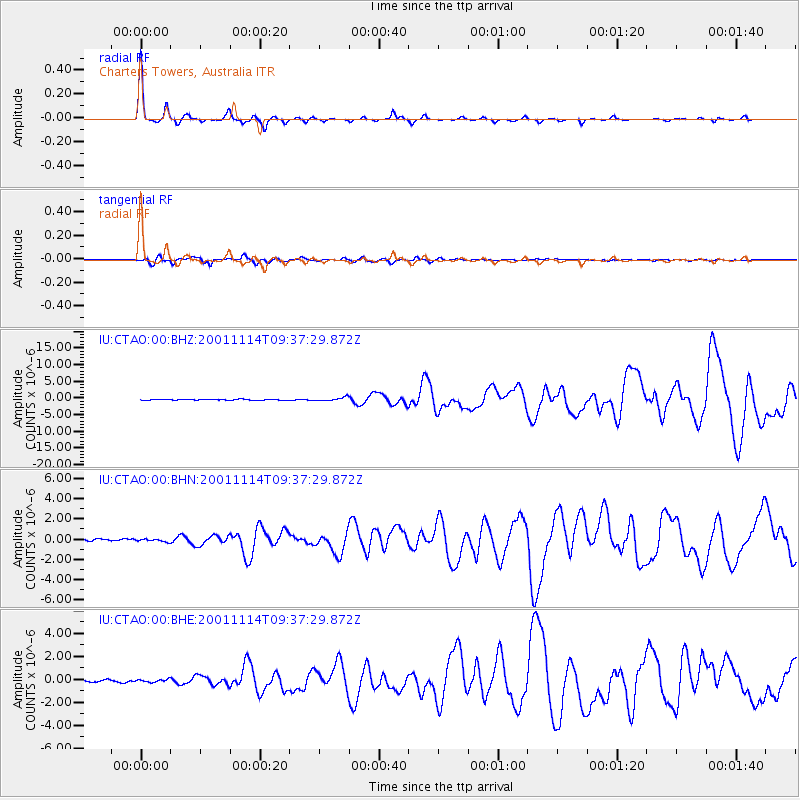
Signal To Noise
| Channel | StoN | STA | LTA |
| IU:CTAO:00:BHN:20011114T09:37:29.872Z | 1.948961 | 1.4615833E-7 | 7.499294E-8 |
| IU:CTAO:00:BHE:20011114T09:37:29.872Z | 1.1805236 | 1.2367286E-7 | 1.0476102E-7 |
| IU:CTAO:00:BHZ:20011114T09:37:29.872Z | 4.530955 | 5.33476E-7 | 1.177403E-7 |
| Arrivals |
| Ps | 4.4 SECOND |
| PpPs | 17 SECOND |
| PsPs/PpSs | 21 SECOND |


