CTAO Charters Towers, Australia - Earthquake Result Viewer
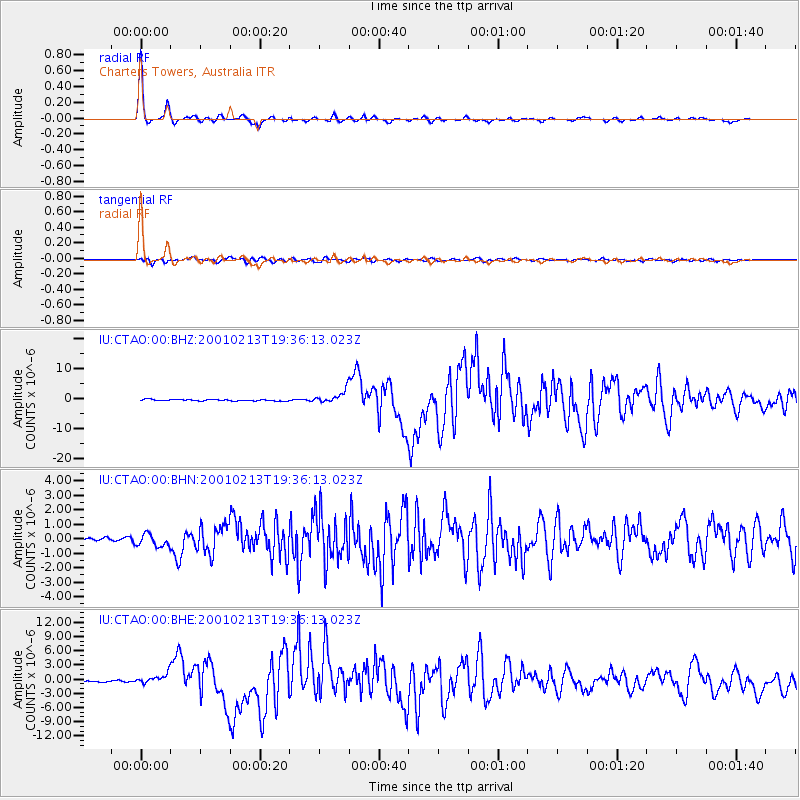
Earthquake location: Southern Sumatra, Indonesia
Earthquake latitude/longitude: -4.7/102.6
Earthquake time(UTC): 2001/02/13 (044) 19:28:30 GMT
Earthquake Depth: 36 km
Earthquake Magnitude: 6.2 MB, 7.2 MS, 7.4 MW, 7.0 ME
Earthquake Catalog/Contributor: WHDF/NEIC
Network: IU Global Seismograph Network (GSN - IRIS/USGS)
Station: CTAO Charters Towers, Australia
Lat/Lon: 20.09 S/146.25 E
Elevation: 357 m
Distance: 45.2 deg
Az: 113.716 deg
Baz: 283.861 deg
Ray Param: 0.07137854
Estimated Moho Depth: 41.25 km
Estimated Crust Vp/Vs: 1.66
Assumed Crust Vp: 6.522 km/s
Estimated Crust Vs: 3.917 km/s
Estimated Crust Poisson's Ratio: 0.22
Radial Match: 97.6544 %
Radial Bump: 240
Transverse Match: 87.96704 %
Transverse Bump: 400
SOD ConfigId: 3744
Insert Time: 2010-03-03 14:30:44.317 +0000
GWidth: 2.5
Max Bumps: 400
Tol: 0.001

Signal To Noise

ChannelStoNSTALTA
IU:CTAO:00:BHN:20010213T19:36:13.023Z2.12811284.33161E-72.0354231E-7
IU:CTAO:00:BHE:20010213T19:36:13.023Z6.53706651.072893E-61.6412454E-7
IU:CTAO:00:BHZ:20010213T19:36:13.023Z8.6885742.0694006E-62.3817496E-7
Arrivals
Ps4.5 SECOND
PpPs16 SECOND
PsPs/PpSs20 SECOND