You are here: Home > Network List > UW - Pacific Northwest Regional Seismic Network Stations List
> Station MRBL Marblemount, WA, USA > Earthquake Result Viewer
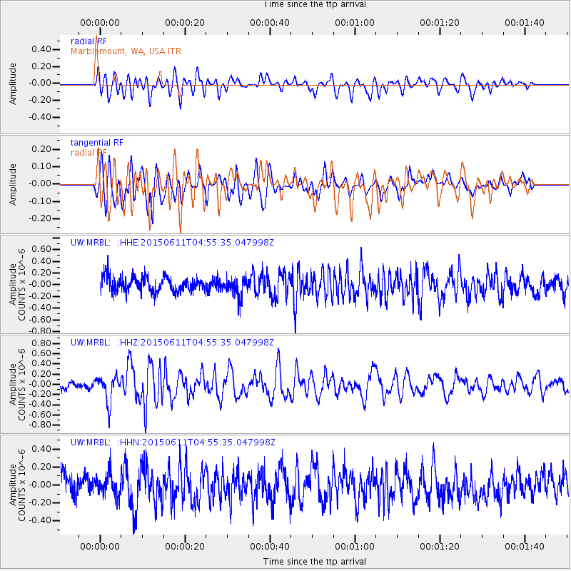
MRBL Marblemount, WA, USA - Earthquake Result Viewer
*The percent match for this event was below the threshold and hence no stack was calculated.
| Earthquake location: |
Off East Coast Of Honshu, Japan |
| Earthquake latitude/longitude: |
39.6/143.4 |
| Earthquake time(UTC): |
2015/06/11 (162) 04:45:30 GMT |
| Earthquake Depth: |
13 km |
| Earthquake Magnitude: |
5.7 MB |
| Earthquake Catalog/Contributor: |
NEIC PDE/NEIC ALERT |
|
| Network: |
UW Pacific Northwest Regional Seismic Network |
| Station: |
MRBL Marblemount, WA, USA |
| Lat/Lon: |
48.52 N/121.48 W |
| Elevation: |
75 m |
|
| Distance: |
64.6 deg |
| Az: |
47.15 deg |
| Baz: |
301.615 deg |
| Ray Param: |
$rayparam |
*The percent match for this event was below the threshold and hence was not used in the summary stack. |
|
| Radial Match: |
58.034473 % |
| Radial Bump: |
400 |
| Transverse Match: |
61.658974 % |
| Transverse Bump: |
400 |
| SOD ConfigId: |
7422571 |
| Insert Time: |
2019-04-19 07:24:19.105 +0000 |
| GWidth: |
2.5 |
| Max Bumps: |
400 |
| Tol: |
0.001 |
|
Signal To Noise
| Channel | StoN | STA | LTA |
| UW:MRBL: :HHZ:20150611T04:55:35.047998Z | 3.8361506 | 2.5696585E-7 | 6.698534E-8 |
| UW:MRBL: :HHN:20150611T04:55:35.047998Z | 1.0093248 | 1.2465487E-7 | 1.2350324E-7 |
| UW:MRBL: :HHE:20150611T04:55:35.047998Z | 1.2667321 | 1.6193565E-7 | 1.2783732E-7 |
| Arrivals |
| Ps | |
| PpPs | |
| PsPs/PpSs | |


