You are here: Home > Network List > IU - Global Seismograph Network (GSN - IRIS/USGS) Stations List
> Station CTAO Charters Towers, Australia > Earthquake Result Viewer
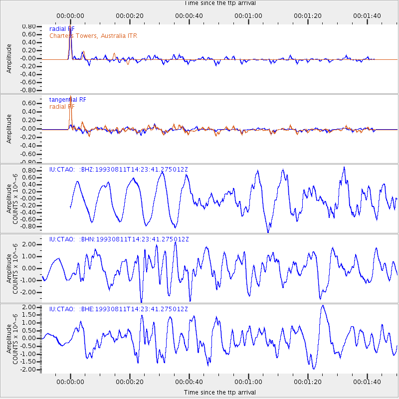
CTAO Charters Towers, Australia - Earthquake Result Viewer
*The percent match for this event was below the threshold and hence no stack was calculated.
| Earthquake location: |
Mariana Islands |
| Earthquake latitude/longitude: |
13.1/145.6 |
| Earthquake time(UTC): |
1993/08/11 (223) 14:17:41 GMT |
| Earthquake Depth: |
56 km |
| Earthquake Magnitude: |
6.0 MB, 6.2 MS, 6.1 UNKNOWN, 6.2 MW |
| Earthquake Catalog/Contributor: |
WHDF/NEIC |
|
| Network: |
IU Global Seismograph Network (GSN - IRIS/USGS) |
| Station: |
CTAO Charters Towers, Australia |
| Lat/Lon: |
20.09 S/146.25 E |
| Elevation: |
357 m |
|
| Distance: |
33.0 deg |
| Az: |
178.902 deg |
| Baz: |
358.862 deg |
| Ray Param: |
$rayparam |
*The percent match for this event was below the threshold and hence was not used in the summary stack. |
|
| Radial Match: |
79.79126 % |
| Radial Bump: |
362 |
| Transverse Match: |
75.64878 % |
| Transverse Bump: |
391 |
| SOD ConfigId: |
4480 |
| Insert Time: |
2010-03-03 14:31:34.150 +0000 |
| GWidth: |
2.5 |
| Max Bumps: |
400 |
| Tol: |
0.001 |
|
Signal To Noise
| Channel | StoN | STA | LTA |
| IU:CTAO: :BHN:19930811T14:23:41.275012Z | 1.1146007 | 6.0993386E-7 | 5.4722193E-7 |
| IU:CTAO: :BHE:19930811T14:23:41.275012Z | 1.7209115 | 5.7869136E-7 | 3.3627026E-7 |
| IU:CTAO: :BHZ:19930811T14:23:41.275012Z | 1.4081323 | 5.459612E-7 | 3.8772012E-7 |
| Arrivals |
| Ps | |
| PpPs | |
| PsPs/PpSs | |


