You are here: Home > Network List > IU - Global Seismograph Network (GSN - IRIS/USGS) Stations List
> Station CTAO Charters Towers, Australia > Earthquake Result Viewer
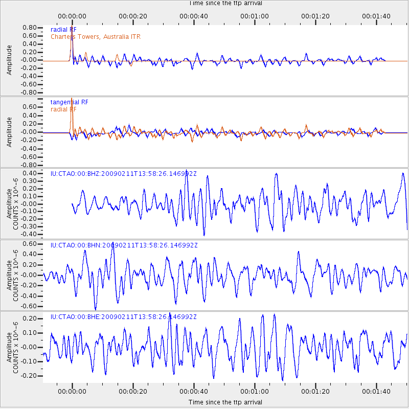
CTAO Charters Towers, Australia - Earthquake Result Viewer
*The percent match for this event was below the threshold and hence no stack was calculated.
| Earthquake location: |
Fiji Islands |
| Earthquake latitude/longitude: |
-16.2/178.3 |
| Earthquake time(UTC): |
2009/02/11 (042) 13:52:41 GMT |
| Earthquake Depth: |
10 km |
| Earthquake Magnitude: |
5.6 MB, 5.3 MS, 5.7 MW, 5.7 MW |
| Earthquake Catalog/Contributor: |
WHDF/NEIC |
|
| Network: |
IU Global Seismograph Network (GSN - IRIS/USGS) |
| Station: |
CTAO Charters Towers, Australia |
| Lat/Lon: |
20.09 S/146.25 E |
| Elevation: |
357 m |
|
| Distance: |
30.7 deg |
| Az: |
257.91 deg |
| Baz: |
88.09 deg |
| Ray Param: |
$rayparam |
*The percent match for this event was below the threshold and hence was not used in the summary stack. |
|
| Radial Match: |
75.62215 % |
| Radial Bump: |
400 |
| Transverse Match: |
59.061424 % |
| Transverse Bump: |
400 |
| SOD ConfigId: |
2658 |
| Insert Time: |
2010-03-03 14:31:39.438 +0000 |
| GWidth: |
2.5 |
| Max Bumps: |
400 |
| Tol: |
0.001 |
|
Signal To Noise
| Channel | StoN | STA | LTA |
| IU:CTAO:00:BHN:20090211T13:58:26.146992Z | 2.783314 | 2.400177E-7 | 8.62345E-8 |
| IU:CTAO:00:BHE:20090211T13:58:26.146992Z | 0.7457692 | 6.111008E-8 | 8.1942346E-8 |
| IU:CTAO:00:BHZ:20090211T13:58:26.146992Z | 1.4816842 | 1.2035868E-7 | 8.123099E-8 |
| Arrivals |
| Ps | |
| PpPs | |
| PsPs/PpSs | |


