You are here: Home > Network List > IU - Global Seismograph Network (GSN - IRIS/USGS) Stations List
> Station CTAO Charters Towers, Australia > Earthquake Result Viewer
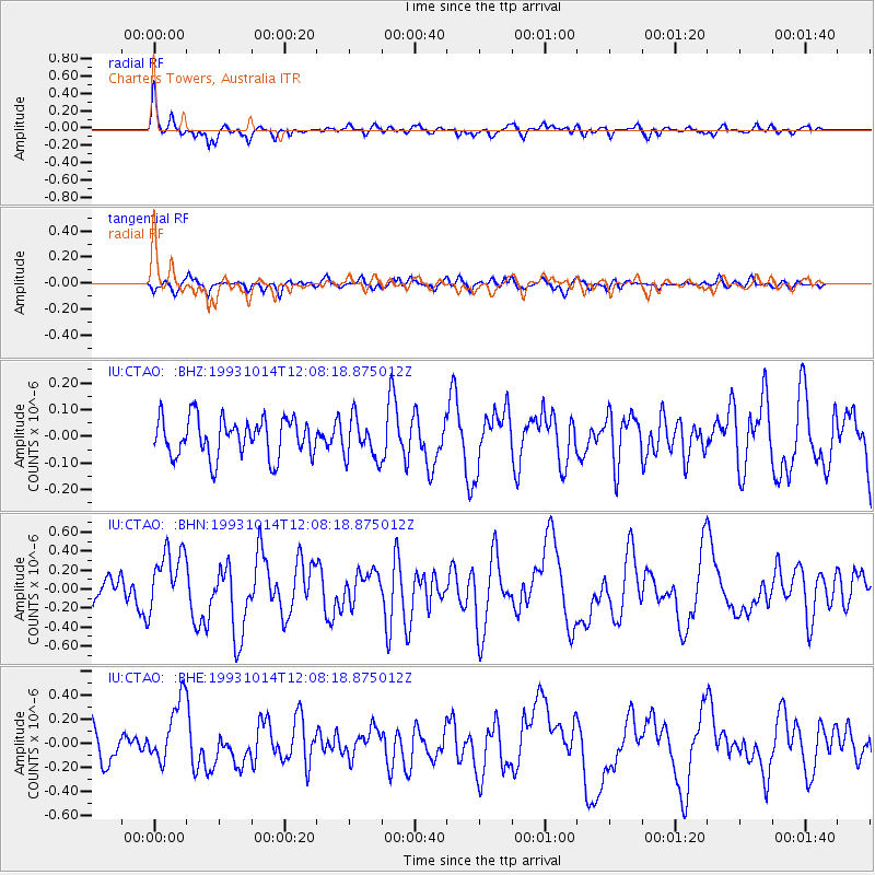
CTAO Charters Towers, Australia - Earthquake Result Viewer
*The percent match for this event was below the threshold and hence no stack was calculated.
| Earthquake location: |
South Of Australia |
| Earthquake latitude/longitude: |
-50.2/139.4 |
| Earthquake time(UTC): |
1993/10/14 (287) 12:02:35 GMT |
| Earthquake Depth: |
10 km |
| Earthquake Magnitude: |
5.6 MS, 5.4 MB |
| Earthquake Catalog/Contributor: |
WHDF/NEIC |
|
| Network: |
IU Global Seismograph Network (GSN - IRIS/USGS) |
| Station: |
CTAO Charters Towers, Australia |
| Lat/Lon: |
20.09 S/146.25 E |
| Elevation: |
357 m |
|
| Distance: |
30.6 deg |
| Az: |
12.689 deg |
| Baz: |
188.631 deg |
| Ray Param: |
$rayparam |
*The percent match for this event was below the threshold and hence was not used in the summary stack. |
|
| Radial Match: |
72.16503 % |
| Radial Bump: |
368 |
| Transverse Match: |
56.874313 % |
| Transverse Bump: |
400 |
| SOD ConfigId: |
4480 |
| Insert Time: |
2010-03-03 14:31:49.462 +0000 |
| GWidth: |
2.5 |
| Max Bumps: |
400 |
| Tol: |
0.001 |
|
Signal To Noise
| Channel | StoN | STA | LTA |
| IU:CTAO: :BHN:19931014T12:08:18.875012Z | 2.5474987 | 3.3354027E-7 | 1.3092853E-7 |
| IU:CTAO: :BHE:19931014T12:08:18.875012Z | 2.7342687 | 2.6843514E-7 | 9.817438E-8 |
| IU:CTAO: :BHZ:19931014T12:08:18.875012Z | 1.0533704 | 7.6538896E-8 | 7.266096E-8 |
| Arrivals |
| Ps | |
| PpPs | |
| PsPs/PpSs | |


