You are here: Home > Network List > IU - Global Seismograph Network (GSN - IRIS/USGS) Stations List
> Station CTAO Charters Towers, Australia > Earthquake Result Viewer
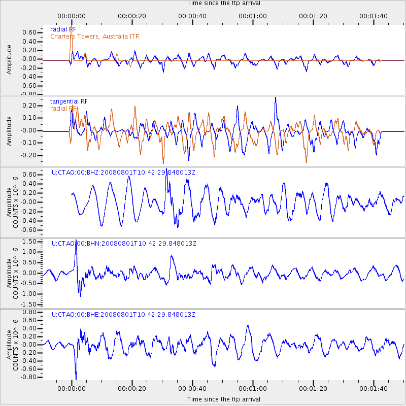
CTAO Charters Towers, Australia - Earthquake Result Viewer
*The percent match for this event was below the threshold and hence no stack was calculated.
| Earthquake location: |
Mindoro, Philippines |
| Earthquake latitude/longitude: |
13.5/120.8 |
| Earthquake time(UTC): |
2008/08/01 (214) 10:35:24 GMT |
| Earthquake Depth: |
135 km |
| Earthquake Magnitude: |
5.6 MW, 5.3 MB, 5.5 MW |
| Earthquake Catalog/Contributor: |
WHDF/NEIC |
|
| Network: |
IU Global Seismograph Network (GSN - IRIS/USGS) |
| Station: |
CTAO Charters Towers, Australia |
| Lat/Lon: |
20.09 S/146.25 E |
| Elevation: |
357 m |
|
| Distance: |
41.8 deg |
| Az: |
142.596 deg |
| Baz: |
321.053 deg |
| Ray Param: |
$rayparam |
*The percent match for this event was below the threshold and hence was not used in the summary stack. |
|
| Radial Match: |
55.10697 % |
| Radial Bump: |
400 |
| Transverse Match: |
49.431072 % |
| Transverse Bump: |
305 |
| SOD ConfigId: |
2504 |
| Insert Time: |
2010-03-03 14:31:51.622 +0000 |
| GWidth: |
2.5 |
| Max Bumps: |
400 |
| Tol: |
0.001 |
|
Signal To Noise
| Channel | StoN | STA | LTA |
| IU:CTAO:00:BHN:20080801T10:42:29.848013Z | 2.9810395 | 6.112436E-7 | 2.0504376E-7 |
| IU:CTAO:00:BHE:20080801T10:42:29.848013Z | 2.4660969 | 2.7689197E-7 | 1.1227943E-7 |
| IU:CTAO:00:BHZ:20080801T10:42:29.848013Z | 1.1046658 | 3.1046855E-7 | 2.8105202E-7 |
| Arrivals |
| Ps | |
| PpPs | |
| PsPs/PpSs | |


