You are here: Home > Network List > IU - Global Seismograph Network (GSN - IRIS/USGS) Stations List
> Station CTAO Charters Towers, Australia > Earthquake Result Viewer
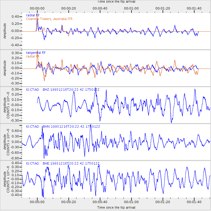
CTAO Charters Towers, Australia - Earthquake Result Viewer
*The percent match for this event was below the threshold and hence no stack was calculated.
| Earthquake location: |
Near Islands, Aleutian Islands |
| Earthquake latitude/longitude: |
53.8/171.5 |
| Earthquake time(UTC): |
1993/12/16 (350) 20:11:25 GMT |
| Earthquake Depth: |
30 km |
| Earthquake Magnitude: |
5.8 MB, 5.7 MS, 6.1 UNKNOWN |
| Earthquake Catalog/Contributor: |
WHDF/NEIC |
|
| Network: |
IU Global Seismograph Network (GSN - IRIS/USGS) |
| Station: |
CTAO Charters Towers, Australia |
| Lat/Lon: |
20.09 S/146.25 E |
| Elevation: |
357 m |
|
| Distance: |
76.7 deg |
| Az: |
204.314 deg |
| Baz: |
15.075 deg |
| Ray Param: |
$rayparam |
*The percent match for this event was below the threshold and hence was not used in the summary stack. |
|
| Radial Match: |
73.859505 % |
| Radial Bump: |
400 |
| Transverse Match: |
58.774826 % |
| Transverse Bump: |
400 |
| SOD ConfigId: |
4480 |
| Insert Time: |
2010-03-03 14:32:00.256 +0000 |
| GWidth: |
2.5 |
| Max Bumps: |
400 |
| Tol: |
0.001 |
|
Signal To Noise
| Channel | StoN | STA | LTA |
| IU:CTAO: :BHN:19931216T20:22:42.175012Z | 2.8446207 | 3.5691372E-7 | 1.2546971E-7 |
| IU:CTAO: :BHE:19931216T20:22:42.175012Z | 1.5959342 | 1.7658839E-7 | 1.1064893E-7 |
| IU:CTAO: :BHZ:19931216T20:22:42.175012Z | 0.8976487 | 8.622233E-8 | 9.605353E-8 |
| Arrivals |
| Ps | |
| PpPs | |
| PsPs/PpSs | |


