You are here: Home > Network List > IU - Global Seismograph Network (GSN - IRIS/USGS) Stations List
> Station CTAO Charters Towers, Australia > Earthquake Result Viewer
CTAO Charters Towers, Australia - Earthquake Result Viewer
*The percent match for this event was below the threshold and hence no stack was calculated.
| Earthquake location: |
Tajikistan-Xinjiang Border Reg. |
| Earthquake latitude/longitude: |
39.5/73.9 |
| Earthquake time(UTC): |
2008/10/05 (279) 16:11:10 GMT |
| Earthquake Depth: |
35 km |
| Earthquake Magnitude: |
5.6 MB |
| Earthquake Catalog/Contributor: |
WHDF/NEIC |
|
| Network: |
IU Global Seismograph Network (GSN - IRIS/USGS) |
| Station: |
CTAO Charters Towers, Australia |
| Lat/Lon: |
20.09 S/146.25 E |
| Elevation: |
357 m |
|
| Distance: |
89.8 deg |
| Az: |
116.395 deg |
| Baz: |
312.499 deg |
| Ray Param: |
$rayparam |
*The percent match for this event was below the threshold and hence was not used in the summary stack. |
|
| Radial Match: |
52.238678 % |
| Radial Bump: |
395 |
| Transverse Match: |
48.75697 % |
| Transverse Bump: |
400 |
| SOD ConfigId: |
2556 |
| Insert Time: |
2010-03-03 14:32:10.293 +0000 |
| GWidth: |
2.5 |
| Max Bumps: |
400 |
| Tol: |
0.001 |
|
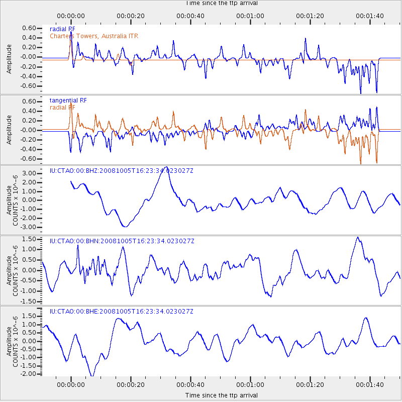
Signal To Noise
| Channel | StoN | STA | LTA |
| IU:CTAO:00:BHN:20081005T16:23:34.023027Z | 0.81382555 | 4.5169563E-7 | 5.550276E-7 |
| IU:CTAO:00:BHE:20081005T16:23:34.023027Z | 0.60701513 | 6.6729405E-7 | 1.0993037E-6 |
| IU:CTAO:00:BHZ:20081005T16:23:34.023027Z | 2.0283332 | 3.209112E-6 | 1.5821425E-6 |
| Arrivals |
| Ps | |
| PpPs | |
| PsPs/PpSs | |


