You are here: Home > Network List > BK - Berkeley Digital Seismograph Network Stations List
> Station HUMO Hull Mountain, OR > Earthquake Result Viewer
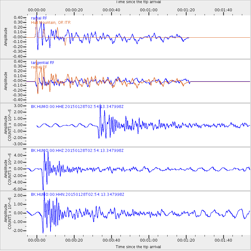
HUMO Hull Mountain, OR - Earthquake Result Viewer
*The percent match for this event was below the threshold and hence no stack was calculated.
| Earthquake location: |
Fiji Islands Region |
| Earthquake latitude/longitude: |
-20.9/-178.4 |
| Earthquake time(UTC): |
2015/01/28 (028) 02:43:19 GMT |
| Earthquake Depth: |
484 km |
| Earthquake Magnitude: |
6.1 MWP |
| Earthquake Catalog/Contributor: |
NEIC PDE/NEIC COMCAT |
|
| Network: |
BK Berkeley Digital Seismograph Network |
| Station: |
HUMO Hull Mountain, OR |
| Lat/Lon: |
42.61 N/122.96 W |
| Elevation: |
555 m |
|
| Distance: |
81.2 deg |
| Az: |
37.943 deg |
| Baz: |
231.14 deg |
| Ray Param: |
$rayparam |
*The percent match for this event was below the threshold and hence was not used in the summary stack. |
|
| Radial Match: |
77.32106 % |
| Radial Bump: |
400 |
| Transverse Match: |
60.14479 % |
| Transverse Bump: |
400 |
| SOD ConfigId: |
837871 |
| Insert Time: |
2015-02-11 05:26:05.089 +0000 |
| GWidth: |
2.5 |
| Max Bumps: |
400 |
| Tol: |
0.001 |
|
Signal To Noise
| Channel | StoN | STA | LTA |
| BK:HUMO:00:HHZ:20150128T02:54:13.347998Z | 8.816491 | 2.1119733E-6 | 2.3954803E-7 |
| BK:HUMO:00:HHN:20150128T02:54:13.347998Z | 5.1555967 | 8.290266E-7 | 1.6080128E-7 |
| BK:HUMO:00:HHE:20150128T02:54:13.347998Z | 6.257922 | 1.041297E-6 | 1.663966E-7 |
| Arrivals |
| Ps | |
| PpPs | |
| PsPs/PpSs | |


