You are here: Home > Network List > IU - Global Seismograph Network (GSN - IRIS/USGS) Stations List
> Station CTAO Charters Towers, Australia > Earthquake Result Viewer
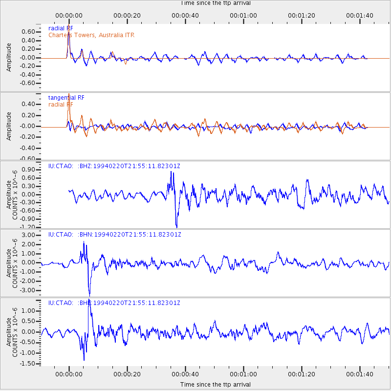
CTAO Charters Towers, Australia - Earthquake Result Viewer
*The percent match for this event was below the threshold and hence no stack was calculated.
| Earthquake location: |
Mindoro, Philippines |
| Earthquake latitude/longitude: |
13.7/120.8 |
| Earthquake time(UTC): |
1994/02/20 (051) 21:48:13 GMT |
| Earthquake Depth: |
219 km |
| Earthquake Magnitude: |
5.5 MB |
| Earthquake Catalog/Contributor: |
WHDF/NEIC |
|
| Network: |
IU Global Seismograph Network (GSN - IRIS/USGS) |
| Station: |
CTAO Charters Towers, Australia |
| Lat/Lon: |
20.09 S/146.25 E |
| Elevation: |
357 m |
|
| Distance: |
41.9 deg |
| Az: |
142.793 deg |
| Baz: |
321.296 deg |
| Ray Param: |
$rayparam |
*The percent match for this event was below the threshold and hence was not used in the summary stack. |
|
| Radial Match: |
79.71355 % |
| Radial Bump: |
331 |
| Transverse Match: |
60.626034 % |
| Transverse Bump: |
400 |
| SOD ConfigId: |
4480 |
| Insert Time: |
2010-03-03 14:32:14.408 +0000 |
| GWidth: |
2.5 |
| Max Bumps: |
400 |
| Tol: |
0.001 |
|
Signal To Noise
| Channel | StoN | STA | LTA |
| IU:CTAO: :BHN:19940220T21:55:11.82301Z | 2.696226 | 4.6864798E-7 | 1.7381628E-7 |
| IU:CTAO: :BHE:19940220T21:55:11.82301Z | 1.8108903 | 2.8393313E-7 | 1.56792E-7 |
| IU:CTAO: :BHZ:19940220T21:55:11.82301Z | 1.4541644 | 1.6006793E-7 | 1.1007554E-7 |
| Arrivals |
| Ps | |
| PpPs | |
| PsPs/PpSs | |


