You are here: Home > Network List > IU - Global Seismograph Network (GSN - IRIS/USGS) Stations List
> Station CTAO Charters Towers, Australia > Earthquake Result Viewer
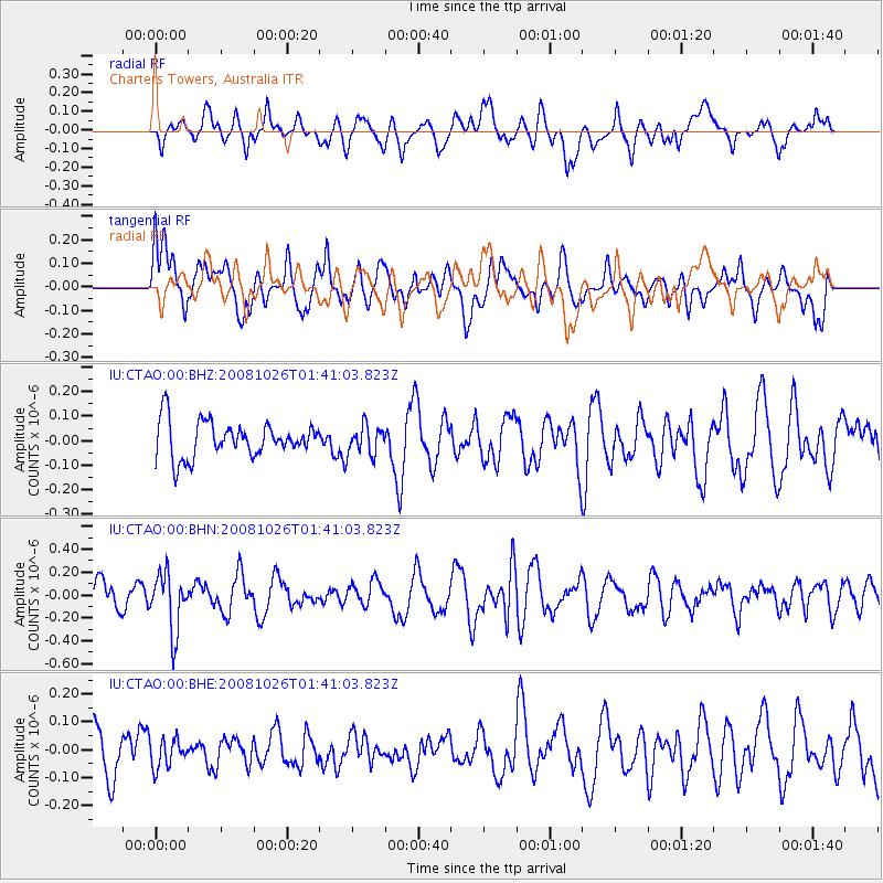
CTAO Charters Towers, Australia - Earthquake Result Viewer
*The percent match for this event was below the threshold and hence no stack was calculated.
| Earthquake location: |
Hindu Kush Region, Afghanistan |
| Earthquake latitude/longitude: |
36.5/70.7 |
| Earthquake time(UTC): |
2008/10/26 (300) 01:28:56 GMT |
| Earthquake Depth: |
210 km |
| Earthquake Magnitude: |
5.5 MB, 5.7 MW, 5.7 MW |
| Earthquake Catalog/Contributor: |
WHDF/NEIC |
|
| Network: |
IU Global Seismograph Network (GSN - IRIS/USGS) |
| Station: |
CTAO Charters Towers, Australia |
| Lat/Lon: |
20.09 S/146.25 E |
| Elevation: |
357 m |
|
| Distance: |
90.8 deg |
| Az: |
114.447 deg |
| Baz: |
308.692 deg |
| Ray Param: |
$rayparam |
*The percent match for this event was below the threshold and hence was not used in the summary stack. |
|
| Radial Match: |
60.286304 % |
| Radial Bump: |
400 |
| Transverse Match: |
61.87885 % |
| Transverse Bump: |
400 |
| SOD ConfigId: |
2560 |
| Insert Time: |
2010-03-03 14:32:29.614 +0000 |
| GWidth: |
2.5 |
| Max Bumps: |
400 |
| Tol: |
0.001 |
|
Signal To Noise
| Channel | StoN | STA | LTA |
| IU:CTAO:00:BHN:20081026T01:41:03.823Z | 2.2045934 | 2.4759197E-7 | 1.12307326E-7 |
| IU:CTAO:00:BHE:20081026T01:41:03.823Z | 0.52443457 | 4.974808E-8 | 9.486041E-8 |
| IU:CTAO:00:BHZ:20081026T01:41:03.823Z | 0.815927 | 5.914167E-8 | 7.248402E-8 |
| Arrivals |
| Ps | |
| PpPs | |
| PsPs/PpSs | |


