You are here: Home > Network List > IU - Global Seismograph Network (GSN - IRIS/USGS) Stations List
> Station CTAO Charters Towers, Australia > Earthquake Result Viewer
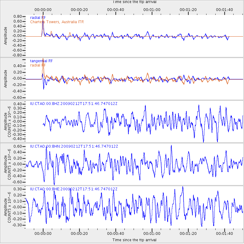
CTAO Charters Towers, Australia - Earthquake Result Viewer
*The percent match for this event was below the threshold and hence no stack was calculated.
| Earthquake location: |
Talaud Islands, Indonesia |
| Earthquake latitude/longitude: |
4.0/126.5 |
| Earthquake time(UTC): |
2009/02/12 (043) 17:46:05 GMT |
| Earthquake Depth: |
44 km |
| Earthquake Magnitude: |
5.7 MB, 5.3 MS, 5.5 MW, 5.5 MW |
| Earthquake Catalog/Contributor: |
WHDF/NEIC |
|
| Network: |
IU Global Seismograph Network (GSN - IRIS/USGS) |
| Station: |
CTAO Charters Towers, Australia |
| Lat/Lon: |
20.09 S/146.25 E |
| Elevation: |
357 m |
|
| Distance: |
30.8 deg |
| Az: |
141.631 deg |
| Baz: |
318.789 deg |
| Ray Param: |
$rayparam |
*The percent match for this event was below the threshold and hence was not used in the summary stack. |
|
| Radial Match: |
60.694218 % |
| Radial Bump: |
370 |
| Transverse Match: |
48.693096 % |
| Transverse Bump: |
400 |
| SOD ConfigId: |
2658 |
| Insert Time: |
2010-03-03 14:32:32.648 +0000 |
| GWidth: |
2.5 |
| Max Bumps: |
400 |
| Tol: |
0.001 |
|
Signal To Noise
| Channel | StoN | STA | LTA |
| IU:CTAO:00:BHN:20090212T17:51:46.747012Z | 2.9102933 | 2.8712634E-7 | 9.86589E-8 |
| IU:CTAO:00:BHE:20090212T17:51:46.747012Z | 1.4428495 | 1.3443936E-7 | 9.317628E-8 |
| IU:CTAO:00:BHZ:20090212T17:51:46.747012Z | 1.942584 | 1.7997452E-7 | 9.2646964E-8 |
| Arrivals |
| Ps | |
| PpPs | |
| PsPs/PpSs | |


