You are here: Home > Network List > IU - Global Seismograph Network (GSN - IRIS/USGS) Stations List
> Station CTAO Charters Towers, Australia > Earthquake Result Viewer
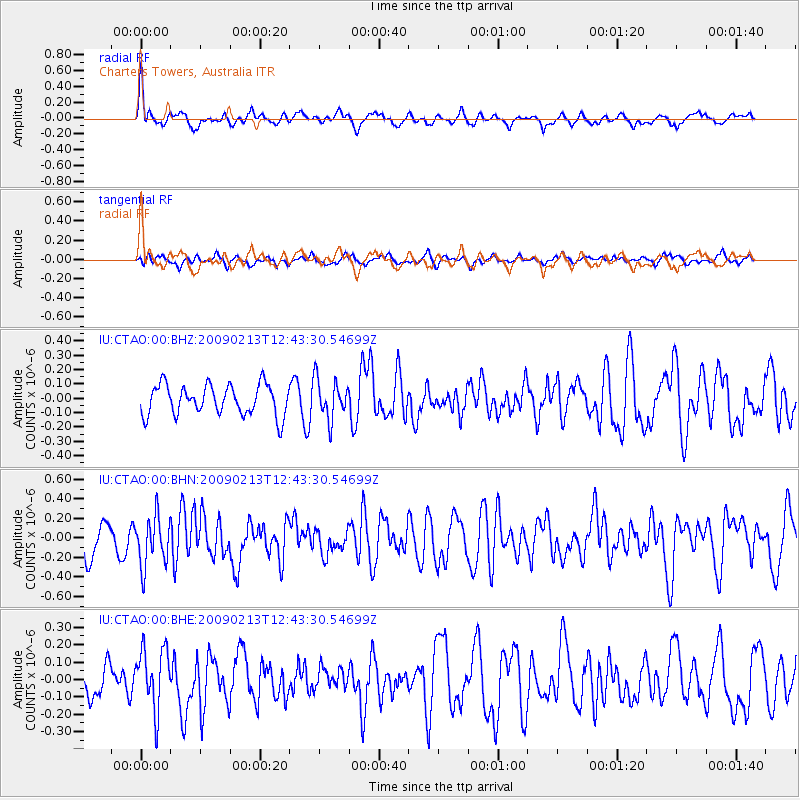
CTAO Charters Towers, Australia - Earthquake Result Viewer
*The percent match for this event was below the threshold and hence no stack was calculated.
| Earthquake location: |
Talaud Islands, Indonesia |
| Earthquake latitude/longitude: |
3.8/126.7 |
| Earthquake time(UTC): |
2009/02/13 (044) 12:37:51 GMT |
| Earthquake Depth: |
35 km |
| Earthquake Magnitude: |
5.5 MB, 5.2 MS, 5.6 MW, 5.3 MW |
| Earthquake Catalog/Contributor: |
WHDF/NEIC |
|
| Network: |
IU Global Seismograph Network (GSN - IRIS/USGS) |
| Station: |
CTAO Charters Towers, Australia |
| Lat/Lon: |
20.09 S/146.25 E |
| Elevation: |
357 m |
|
| Distance: |
30.5 deg |
| Az: |
141.733 deg |
| Baz: |
318.889 deg |
| Ray Param: |
$rayparam |
*The percent match for this event was below the threshold and hence was not used in the summary stack. |
|
| Radial Match: |
68.27559 % |
| Radial Bump: |
400 |
| Transverse Match: |
53.895954 % |
| Transverse Bump: |
400 |
| SOD ConfigId: |
2658 |
| Insert Time: |
2010-03-03 14:32:36.121 +0000 |
| GWidth: |
2.5 |
| Max Bumps: |
400 |
| Tol: |
0.001 |
|
Signal To Noise
| Channel | StoN | STA | LTA |
| IU:CTAO:00:BHN:20090213T12:43:30.54699Z | 1.7390288 | 2.5410938E-7 | 1.4612144E-7 |
| IU:CTAO:00:BHE:20090213T12:43:30.54699Z | 1.6287405 | 1.7827452E-7 | 1.0945545E-7 |
| IU:CTAO:00:BHZ:20090213T12:43:30.54699Z | 1.3047656 | 1.3774988E-7 | 1.0557443E-7 |
| Arrivals |
| Ps | |
| PpPs | |
| PsPs/PpSs | |


