You are here: Home > Network List > IU - Global Seismograph Network (GSN - IRIS/USGS) Stations List
> Station CTAO Charters Towers, Australia > Earthquake Result Viewer
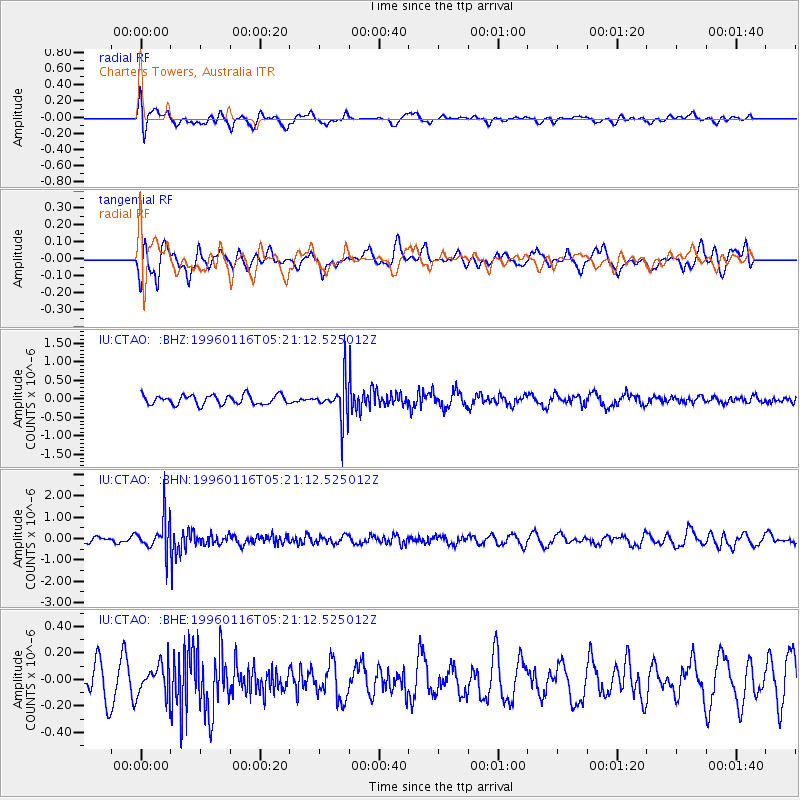
CTAO Charters Towers, Australia - Earthquake Result Viewer
*The percent match for this event was below the threshold and hence no stack was calculated.
| Earthquake location: |
Fiji Islands Region |
| Earthquake latitude/longitude: |
-18.7/-177.5 |
| Earthquake time(UTC): |
1996/01/16 (016) 05:15:27 GMT |
| Earthquake Depth: |
334 km |
| Earthquake Magnitude: |
5.7 UNKNOWN, 5.4 MB |
| Earthquake Catalog/Contributor: |
WHDF/NEIC |
|
| Network: |
IU Global Seismograph Network (GSN - IRIS/USGS) |
| Station: |
CTAO Charters Towers, Australia |
| Lat/Lon: |
20.09 S/146.25 E |
| Elevation: |
357 m |
|
| Distance: |
34.2 deg |
| Az: |
261.599 deg |
| Baz: |
93.949 deg |
| Ray Param: |
$rayparam |
*The percent match for this event was below the threshold and hence was not used in the summary stack. |
|
| Radial Match: |
64.99965 % |
| Radial Bump: |
400 |
| Transverse Match: |
66.4957 % |
| Transverse Bump: |
400 |
| SOD ConfigId: |
4480 |
| Insert Time: |
2010-03-03 14:32:43.208 +0000 |
| GWidth: |
2.5 |
| Max Bumps: |
400 |
| Tol: |
0.001 |
|
Signal To Noise
| Channel | StoN | STA | LTA |
| IU:CTAO: :BHN:19960116T05:21:12.525012Z | 5.1849246 | 8.242761E-7 | 1.5897552E-7 |
| IU:CTAO: :BHE:19960116T05:21:12.525012Z | 1.266201 | 1.158601E-7 | 9.150214E-8 |
| IU:CTAO: :BHZ:19960116T05:21:12.525012Z | 4.103789 | 5.1847996E-7 | 1.2634177E-7 |
| Arrivals |
| Ps | |
| PpPs | |
| PsPs/PpSs | |


