You are here: Home > Network List > IU - Global Seismograph Network (GSN - IRIS/USGS) Stations List
> Station CTAO Charters Towers, Australia > Earthquake Result Viewer
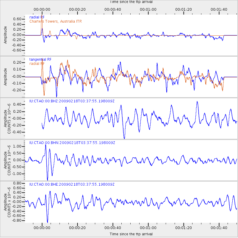
CTAO Charters Towers, Australia - Earthquake Result Viewer
*The percent match for this event was below the threshold and hence no stack was calculated.
| Earthquake location: |
Balleny Islands Region |
| Earthquake latitude/longitude: |
-61.7/154.8 |
| Earthquake time(UTC): |
2009/02/18 (049) 03:30:34 GMT |
| Earthquake Depth: |
10 km |
| Earthquake Magnitude: |
5.7 MW, 5.2 MB |
| Earthquake Catalog/Contributor: |
WHDF/NEIC |
|
| Network: |
IU Global Seismograph Network (GSN - IRIS/USGS) |
| Station: |
CTAO Charters Towers, Australia |
| Lat/Lon: |
20.09 S/146.25 E |
| Elevation: |
357 m |
|
| Distance: |
42.0 deg |
| Az: |
348.021 deg |
| Baz: |
173.961 deg |
| Ray Param: |
$rayparam |
*The percent match for this event was below the threshold and hence was not used in the summary stack. |
|
| Radial Match: |
60.353252 % |
| Radial Bump: |
400 |
| Transverse Match: |
71.8553 % |
| Transverse Bump: |
400 |
| SOD ConfigId: |
2658 |
| Insert Time: |
2010-03-03 14:32:50.200 +0000 |
| GWidth: |
2.5 |
| Max Bumps: |
400 |
| Tol: |
0.001 |
|
Signal To Noise
| Channel | StoN | STA | LTA |
| IU:CTAO:00:BHN:20090218T03:37:55.198009Z | 5.5985003 | 6.4787525E-7 | 1.15723005E-7 |
| IU:CTAO:00:BHE:20090218T03:37:55.198009Z | 3.8833086 | 3.4001317E-7 | 8.75576E-8 |
| IU:CTAO:00:BHZ:20090218T03:37:55.198009Z | 0.67725694 | 9.0469584E-8 | 1.3358236E-7 |
| Arrivals |
| Ps | |
| PpPs | |
| PsPs/PpSs | |


