You are here: Home > Network List > IU - Global Seismograph Network (GSN - IRIS/USGS) Stations List
> Station CTAO Charters Towers, Australia > Earthquake Result Viewer
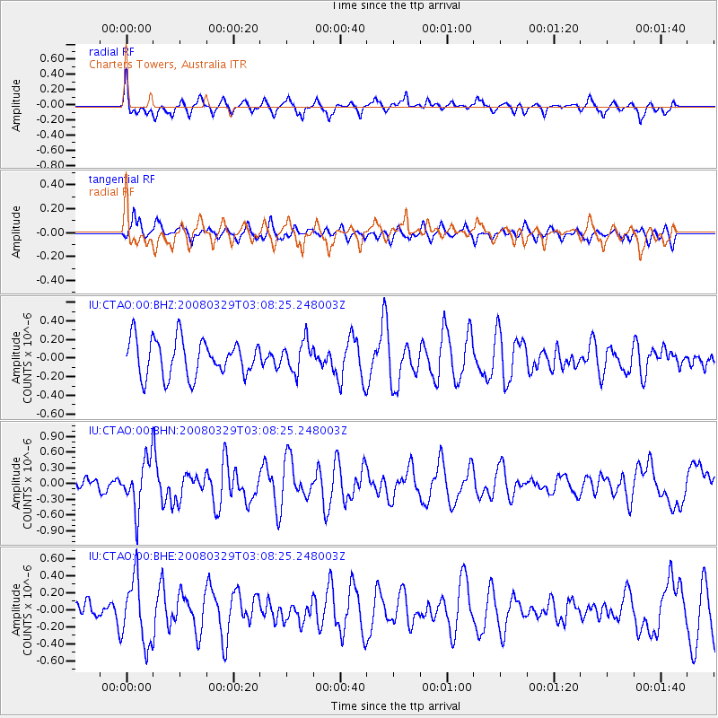
CTAO Charters Towers, Australia - Earthquake Result Viewer
*The percent match for this event was below the threshold and hence no stack was calculated.
| Earthquake location: |
Philippine Islands Region |
| Earthquake latitude/longitude: |
13.3/125.7 |
| Earthquake time(UTC): |
2008/03/29 (089) 03:01:31 GMT |
| Earthquake Depth: |
18 km |
| Earthquake Magnitude: |
5.7 MB, 5.2 MS, 5.7 MW, 5.7 MW |
| Earthquake Catalog/Contributor: |
WHDF/NEIC |
|
| Network: |
IU Global Seismograph Network (GSN - IRIS/USGS) |
| Station: |
CTAO Charters Towers, Australia |
| Lat/Lon: |
20.09 S/146.25 E |
| Elevation: |
357 m |
|
| Distance: |
38.9 deg |
| Az: |
148.228 deg |
| Baz: |
326.947 deg |
| Ray Param: |
$rayparam |
*The percent match for this event was below the threshold and hence was not used in the summary stack. |
|
| Radial Match: |
60.679443 % |
| Radial Bump: |
400 |
| Transverse Match: |
62.26837 % |
| Transverse Bump: |
400 |
| SOD ConfigId: |
2504 |
| Insert Time: |
2010-03-03 14:32:57.524 +0000 |
| GWidth: |
2.5 |
| Max Bumps: |
400 |
| Tol: |
0.001 |
|
Signal To Noise
| Channel | StoN | STA | LTA |
| IU:CTAO:00:BHN:20080329T03:08:25.248003Z | 3.117956 | 4.784025E-7 | 1.5343467E-7 |
| IU:CTAO:00:BHE:20080329T03:08:25.248003Z | 2.029789 | 3.8639894E-7 | 1.9036409E-7 |
| IU:CTAO:00:BHZ:20080329T03:08:25.248003Z | 0.8143978 | 1.610182E-7 | 1.9771444E-7 |
| Arrivals |
| Ps | |
| PpPs | |
| PsPs/PpSs | |


