You are here: Home > Network List > IU - Global Seismograph Network (GSN - IRIS/USGS) Stations List
> Station CTAO Charters Towers, Australia > Earthquake Result Viewer
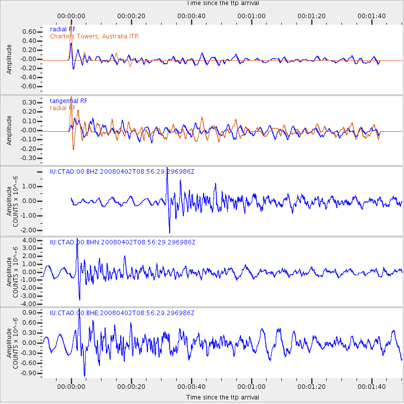
CTAO Charters Towers, Australia - Earthquake Result Viewer
*The percent match for this event was below the threshold and hence no stack was calculated.
| Earthquake location: |
Southern Sumatra, Indonesia |
| Earthquake latitude/longitude: |
-4.3/102.7 |
| Earthquake time(UTC): |
2008/04/02 (093) 08:48:49 GMT |
| Earthquake Depth: |
67 km |
| Earthquake Magnitude: |
5.8 MB, 5.7 MW, 5.6 MW |
| Earthquake Catalog/Contributor: |
WHDF/NEIC |
|
| Network: |
IU Global Seismograph Network (GSN - IRIS/USGS) |
| Station: |
CTAO Charters Towers, Australia |
| Lat/Lon: |
20.09 S/146.25 E |
| Elevation: |
357 m |
|
| Distance: |
45.2 deg |
| Az: |
114.068 deg |
| Baz: |
284.377 deg |
| Ray Param: |
$rayparam |
*The percent match for this event was below the threshold and hence was not used in the summary stack. |
|
| Radial Match: |
58.31096 % |
| Radial Bump: |
400 |
| Transverse Match: |
60.72053 % |
| Transverse Bump: |
400 |
| SOD ConfigId: |
2504 |
| Insert Time: |
2010-03-03 14:32:58.194 +0000 |
| GWidth: |
2.5 |
| Max Bumps: |
400 |
| Tol: |
0.001 |
|
Signal To Noise
| Channel | StoN | STA | LTA |
| IU:CTAO:00:BHN:20080402T08:56:29.296986Z | 3.2952323 | 1.4210726E-6 | 4.3125112E-7 |
| IU:CTAO:00:BHE:20080402T08:56:29.296986Z | 3.280414 | 4.277106E-7 | 1.3038311E-7 |
| IU:CTAO:00:BHZ:20080402T08:56:29.296986Z | 4.571026 | 7.644976E-7 | 1.6724859E-7 |
| Arrivals |
| Ps | |
| PpPs | |
| PsPs/PpSs | |


