You are here: Home > Network List > IU - Global Seismograph Network (GSN - IRIS/USGS) Stations List
> Station CTAO Charters Towers, Australia > Earthquake Result Viewer
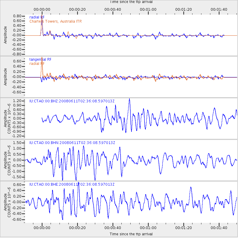
CTAO Charters Towers, Australia - Earthquake Result Viewer
*The percent match for this event was below the threshold and hence no stack was calculated.
| Earthquake location: |
South Of Kermadec Islands |
| Earthquake latitude/longitude: |
-33.4/179.9 |
| Earthquake time(UTC): |
2008/06/11 (163) 02:30:08 GMT |
| Earthquake Depth: |
22 km |
| Earthquake Magnitude: |
5.6 MB, 5.1 MS, 5.7 MW, 5.5 MW |
| Earthquake Catalog/Contributor: |
WHDF/NEIC |
|
| Network: |
IU Global Seismograph Network (GSN - IRIS/USGS) |
| Station: |
CTAO Charters Towers, Australia |
| Lat/Lon: |
20.09 S/146.25 E |
| Elevation: |
357 m |
|
| Distance: |
32.7 deg |
| Az: |
285.355 deg |
| Baz: |
120.88 deg |
| Ray Param: |
$rayparam |
*The percent match for this event was below the threshold and hence was not used in the summary stack. |
|
| Radial Match: |
74.83637 % |
| Radial Bump: |
393 |
| Transverse Match: |
63.3644 % |
| Transverse Bump: |
400 |
| SOD ConfigId: |
2504 |
| Insert Time: |
2010-03-03 14:33:05.167 +0000 |
| GWidth: |
2.5 |
| Max Bumps: |
400 |
| Tol: |
0.001 |
|
Signal To Noise
| Channel | StoN | STA | LTA |
| IU:CTAO:00:BHN:20080611T02:36:08.597013Z | 2.597021 | 4.0371043E-7 | 1.5545135E-7 |
| IU:CTAO:00:BHE:20080611T02:36:08.597013Z | 1.1682979 | 1.2227505E-7 | 1.0466084E-7 |
| IU:CTAO:00:BHZ:20080611T02:36:08.597013Z | 2.2988474 | 4.1696615E-7 | 1.8138053E-7 |
| Arrivals |
| Ps | |
| PpPs | |
| PsPs/PpSs | |


