You are here: Home > Network List > IU - Global Seismograph Network (GSN - IRIS/USGS) Stations List
> Station CTAO Charters Towers, Australia > Earthquake Result Viewer
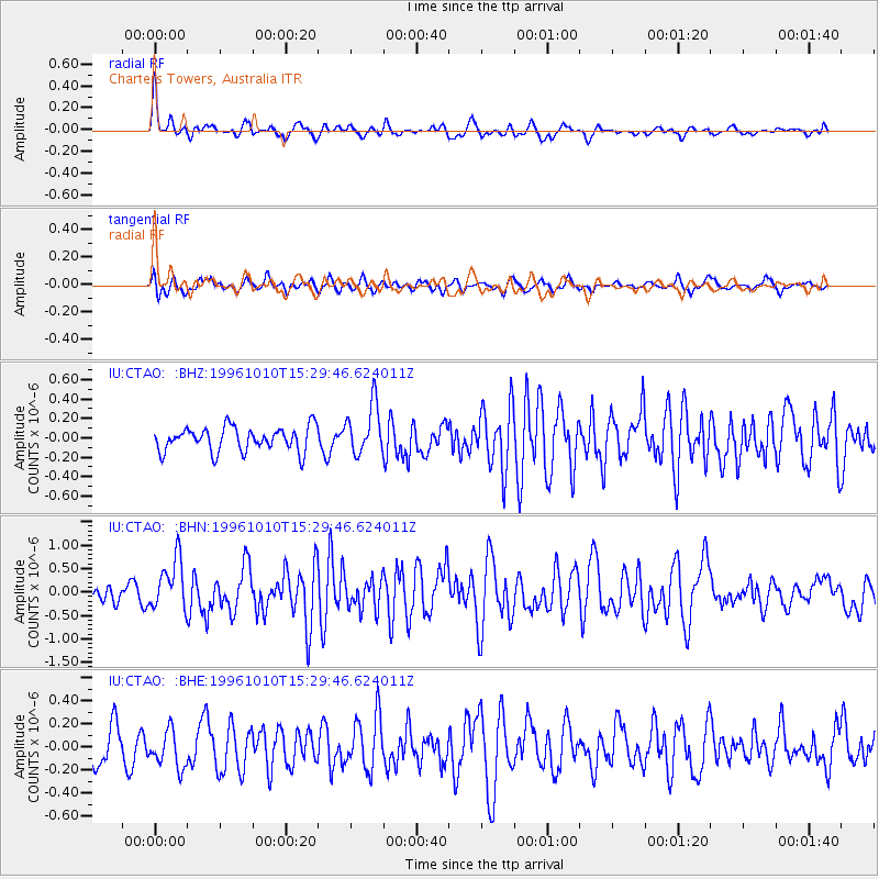
CTAO Charters Towers, Australia - Earthquake Result Viewer
*The percent match for this event was below the threshold and hence no stack was calculated.
| Earthquake location: |
Northern Sumatra, Indonesia |
| Earthquake latitude/longitude: |
3.4/97.9 |
| Earthquake time(UTC): |
1996/10/10 (284) 15:21:04 GMT |
| Earthquake Depth: |
33 km |
| Earthquake Magnitude: |
5.7 MB, 6.1 MS, 6.3 UNKNOWN, 6.2 MW |
| Earthquake Catalog/Contributor: |
WHDF/NEIC |
|
| Network: |
IU Global Seismograph Network (GSN - IRIS/USGS) |
| Station: |
CTAO Charters Towers, Australia |
| Lat/Lon: |
20.09 S/146.25 E |
| Elevation: |
357 m |
|
| Distance: |
52.9 deg |
| Az: |
118.313 deg |
| Baz: |
290.774 deg |
| Ray Param: |
$rayparam |
*The percent match for this event was below the threshold and hence was not used in the summary stack. |
|
| Radial Match: |
73.71536 % |
| Radial Bump: |
400 |
| Transverse Match: |
54.977665 % |
| Transverse Bump: |
400 |
| SOD ConfigId: |
4480 |
| Insert Time: |
2010-03-03 14:33:13.025 +0000 |
| GWidth: |
2.5 |
| Max Bumps: |
400 |
| Tol: |
0.001 |
|
Signal To Noise
| Channel | StoN | STA | LTA |
| IU:CTAO: :BHN:19961010T15:29:46.624011Z | 3.701881 | 5.405026E-7 | 1.4600757E-7 |
| IU:CTAO: :BHE:19961010T15:29:46.624011Z | 1.2681812 | 1.6184215E-7 | 1.2761753E-7 |
| IU:CTAO: :BHZ:19961010T15:29:46.624011Z | 2.0533044 | 2.5725743E-7 | 1.2528946E-7 |
| Arrivals |
| Ps | |
| PpPs | |
| PsPs/PpSs | |


