You are here: Home > Network List > TA - USArray Transportable Network (new EarthScope stations) Stations List
> Station H63A New Sharon, ME, USA > Earthquake Result Viewer
H63A New Sharon, ME, USA - Earthquake Result Viewer
*The percent match for this event was below the threshold and hence no stack was calculated.
| Earthquake location: |
Off East Coast Of Honshu, Japan |
| Earthquake latitude/longitude: |
39.7/143.2 |
| Earthquake time(UTC): |
2015/06/11 (162) 04:56:32 GMT |
| Earthquake Depth: |
10 km |
| Earthquake Magnitude: |
5.8 MO |
| Earthquake Catalog/Contributor: |
NEIC PDE/NEIC ALERT |
|
| Network: |
TA USArray Transportable Network (new EarthScope stations) |
| Station: |
H63A New Sharon, ME, USA |
| Lat/Lon: |
44.66 N/70.04 W |
| Elevation: |
109 m |
|
| Distance: |
90.9 deg |
| Az: |
23.028 deg |
| Baz: |
334.966 deg |
| Ray Param: |
$rayparam |
*The percent match for this event was below the threshold and hence was not used in the summary stack. |
|
| Radial Match: |
59.409767 % |
| Radial Bump: |
400 |
| Transverse Match: |
49.07836 % |
| Transverse Bump: |
400 |
| SOD ConfigId: |
7422571 |
| Insert Time: |
2019-04-19 07:41:21.874 +0000 |
| GWidth: |
2.5 |
| Max Bumps: |
400 |
| Tol: |
0.001 |
|
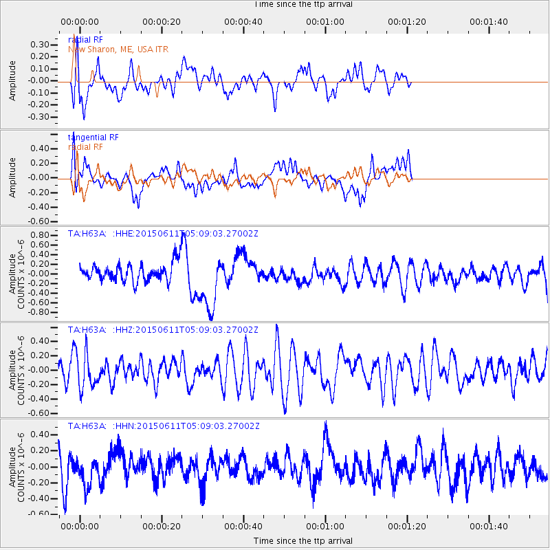
Signal To Noise
| Channel | StoN | STA | LTA |
| TA:H63A: :HHZ:20150611T05:09:03.27002Z | 1.4386675 | 2.4762224E-7 | 1.7211916E-7 |
| TA:H63A: :HHN:20150611T05:09:03.27002Z | 0.9510148 | 1.7126281E-7 | 1.8008427E-7 |
| TA:H63A: :HHE:20150611T05:09:03.27002Z | 2.3324735 | 5.7285064E-7 | 2.4559793E-7 |
| Arrivals |
| Ps | |
| PpPs | |
| PsPs/PpSs | |


