You are here: Home > Network List > IU - Global Seismograph Network (GSN - IRIS/USGS) Stations List
> Station CTAO Charters Towers, Australia > Earthquake Result Viewer
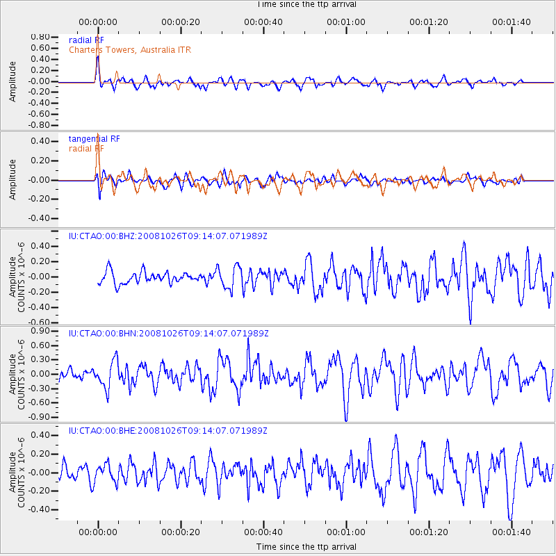
CTAO Charters Towers, Australia - Earthquake Result Viewer
*The percent match for this event was below the threshold and hence no stack was calculated.
| Earthquake location: |
Minahassa Peninsula, Sulawesi |
| Earthquake latitude/longitude: |
-0.1/123.0 |
| Earthquake time(UTC): |
2008/10/26 (300) 09:08:34 GMT |
| Earthquake Depth: |
81 km |
| Earthquake Magnitude: |
5.5 MB, 5.6 MW, 5.6 MW |
| Earthquake Catalog/Contributor: |
WHDF/NEIC |
|
| Network: |
IU Global Seismograph Network (GSN - IRIS/USGS) |
| Station: |
CTAO Charters Towers, Australia |
| Lat/Lon: |
20.09 S/146.25 E |
| Elevation: |
357 m |
|
| Distance: |
30.2 deg |
| Az: |
132.457 deg |
| Baz: |
308.284 deg |
| Ray Param: |
$rayparam |
*The percent match for this event was below the threshold and hence was not used in the summary stack. |
|
| Radial Match: |
59.121174 % |
| Radial Bump: |
400 |
| Transverse Match: |
70.290764 % |
| Transverse Bump: |
400 |
| SOD ConfigId: |
2560 |
| Insert Time: |
2010-03-03 14:33:30.984 +0000 |
| GWidth: |
2.5 |
| Max Bumps: |
400 |
| Tol: |
0.001 |
|
Signal To Noise
| Channel | StoN | STA | LTA |
| IU:CTAO:00:BHN:20081026T09:14:07.071989Z | 2.281836 | 2.919575E-7 | 1.279485E-7 |
| IU:CTAO:00:BHE:20081026T09:14:07.071989Z | 1.1603158 | 9.154976E-8 | 7.8900726E-8 |
| IU:CTAO:00:BHZ:20081026T09:14:07.071989Z | 1.924818 | 1.4431575E-7 | 7.497631E-8 |
| Arrivals |
| Ps | |
| PpPs | |
| PsPs/PpSs | |


