You are here: Home > Network List > TA - USArray Transportable Network (new EarthScope stations) Stations List
> Station R11A Troy Canyon, Currant, NV, USA > Earthquake Result Viewer
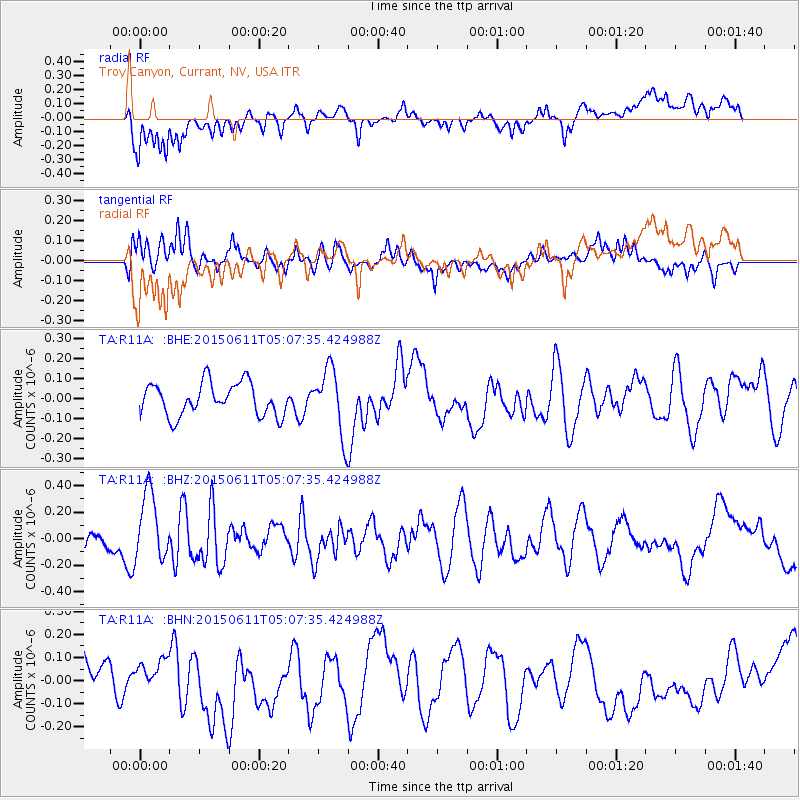
R11A Troy Canyon, Currant, NV, USA - Earthquake Result Viewer
*The percent match for this event was below the threshold and hence no stack was calculated.
| Earthquake location: |
Off East Coast Of Honshu, Japan |
| Earthquake latitude/longitude: |
39.7/143.2 |
| Earthquake time(UTC): |
2015/06/11 (162) 04:56:32 GMT |
| Earthquake Depth: |
10 km |
| Earthquake Magnitude: |
5.8 MO |
| Earthquake Catalog/Contributor: |
NEIC PDE/NEIC ALERT |
|
| Network: |
TA USArray Transportable Network (new EarthScope stations) |
| Station: |
R11A Troy Canyon, Currant, NV, USA |
| Lat/Lon: |
38.35 N/115.59 W |
| Elevation: |
1756 m |
|
| Distance: |
74.1 deg |
| Az: |
53.333 deg |
| Baz: |
308.045 deg |
| Ray Param: |
$rayparam |
*The percent match for this event was below the threshold and hence was not used in the summary stack. |
|
| Radial Match: |
59.655827 % |
| Radial Bump: |
400 |
| Transverse Match: |
44.738094 % |
| Transverse Bump: |
400 |
| SOD ConfigId: |
7422571 |
| Insert Time: |
2019-04-19 07:41:48.999 +0000 |
| GWidth: |
2.5 |
| Max Bumps: |
400 |
| Tol: |
0.001 |
|
Signal To Noise
| Channel | StoN | STA | LTA |
| TA:R11A: :BHZ:20150611T05:07:35.424988Z | 2.3383791 | 2.6276297E-7 | 1.1236969E-7 |
| TA:R11A: :BHN:20150611T05:07:35.424988Z | 0.8810076 | 6.8206255E-8 | 7.7418456E-8 |
| TA:R11A: :BHE:20150611T05:07:35.424988Z | 2.4842823 | 2.0032455E-7 | 8.063679E-8 |
| Arrivals |
| Ps | |
| PpPs | |
| PsPs/PpSs | |


