You are here: Home > Network List > IU - Global Seismograph Network (GSN - IRIS/USGS) Stations List
> Station CTAO Charters Towers, Australia > Earthquake Result Viewer
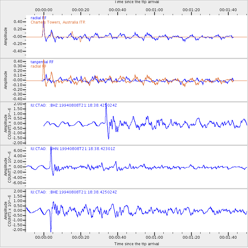
CTAO Charters Towers, Australia - Earthquake Result Viewer
*The percent match for this event was below the threshold and hence no stack was calculated.
| Earthquake location: |
Myanmar |
| Earthquake latitude/longitude: |
24.7/95.2 |
| Earthquake time(UTC): |
1994/08/08 (220) 21:08:31 GMT |
| Earthquake Depth: |
127 km |
| Earthquake Magnitude: |
6.0 MB, 5.1 UNKNOWN, 6.1 MW |
| Earthquake Catalog/Contributor: |
WHDF/NEIC |
|
| Network: |
IU Global Seismograph Network (GSN - IRIS/USGS) |
| Station: |
CTAO Charters Towers, Australia |
| Lat/Lon: |
20.09 S/146.25 E |
| Elevation: |
357 m |
|
| Distance: |
66.7 deg |
| Az: |
127.28 deg |
| Baz: |
309.655 deg |
| Ray Param: |
$rayparam |
*The percent match for this event was below the threshold and hence was not used in the summary stack. |
|
| Radial Match: |
79.23185 % |
| Radial Bump: |
400 |
| Transverse Match: |
68.989105 % |
| Transverse Bump: |
370 |
| SOD ConfigId: |
4480 |
| Insert Time: |
2010-03-03 14:33:48.161 +0000 |
| GWidth: |
2.5 |
| Max Bumps: |
400 |
| Tol: |
0.001 |
|
Signal To Noise
| Channel | StoN | STA | LTA |
| IU:CTAO: :BHN:19940808T21:18:38.42301Z | 7.959803 | 2.1996095E-6 | 2.763397E-7 |
| IU:CTAO: :BHE:19940808T21:18:38.425024Z | 4.717511 | 6.330312E-7 | 1.3418754E-7 |
| IU:CTAO: :BHZ:19940808T21:18:38.425024Z | 4.109767 | 6.175008E-7 | 1.5025202E-7 |
| Arrivals |
| Ps | |
| PpPs | |
| PsPs/PpSs | |


