You are here: Home > Network List > IU - Global Seismograph Network (GSN - IRIS/USGS) Stations List
> Station CTAO Charters Towers, Australia > Earthquake Result Viewer
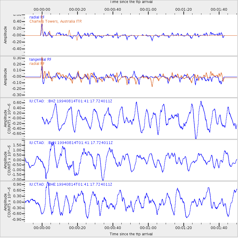
CTAO Charters Towers, Australia - Earthquake Result Viewer
*The percent match for this event was below the threshold and hence no stack was calculated.
| Earthquake location: |
East Of Kuril Islands |
| Earthquake latitude/longitude: |
44.7/150.0 |
| Earthquake time(UTC): |
1994/08/14 (226) 01:31:14 GMT |
| Earthquake Depth: |
33 km |
| Earthquake Magnitude: |
6.1 MB, 6.0 MS, 5.6 UNKNOWN, 6.5 MW |
| Earthquake Catalog/Contributor: |
WHDF/NEIC |
|
| Network: |
IU Global Seismograph Network (GSN - IRIS/USGS) |
| Station: |
CTAO Charters Towers, Australia |
| Lat/Lon: |
20.09 S/146.25 E |
| Elevation: |
357 m |
|
| Distance: |
64.5 deg |
| Az: |
183.908 deg |
| Baz: |
2.965 deg |
| Ray Param: |
$rayparam |
*The percent match for this event was below the threshold and hence was not used in the summary stack. |
|
| Radial Match: |
63.42844 % |
| Radial Bump: |
400 |
| Transverse Match: |
55.997734 % |
| Transverse Bump: |
400 |
| SOD ConfigId: |
4480 |
| Insert Time: |
2010-03-03 14:33:51.630 +0000 |
| GWidth: |
2.5 |
| Max Bumps: |
400 |
| Tol: |
0.001 |
|
Signal To Noise
| Channel | StoN | STA | LTA |
| IU:CTAO: :BHN:19940814T01:41:17.724011Z | 1.8092957 | 8.7144286E-7 | 4.8164753E-7 |
| IU:CTAO: :BHE:19940814T01:41:17.724011Z | 2.670097 | 6.0071744E-7 | 2.2497962E-7 |
| IU:CTAO: :BHZ:19940814T01:41:17.724011Z | 1.0760672 | 2.8309665E-7 | 2.6308453E-7 |
| Arrivals |
| Ps | |
| PpPs | |
| PsPs/PpSs | |


