You are here: Home > Network List > IU - Global Seismograph Network (GSN - IRIS/USGS) Stations List
> Station CTAO Charters Towers, Australia > Earthquake Result Viewer
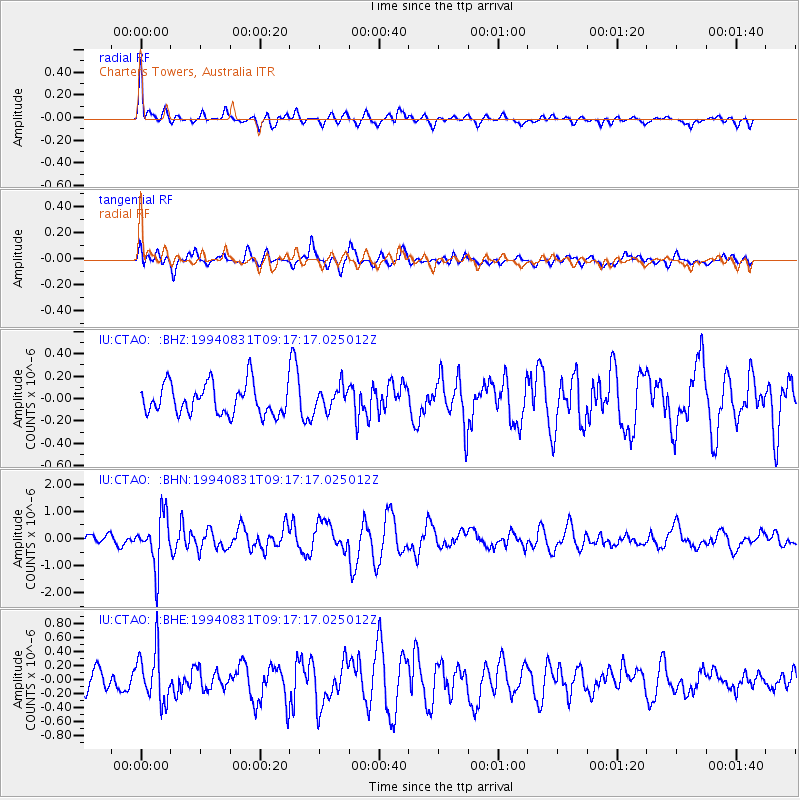
CTAO Charters Towers, Australia - Earthquake Result Viewer
*The percent match for this event was below the threshold and hence no stack was calculated.
| Earthquake location: |
Hokkaido, Japan Region |
| Earthquake latitude/longitude: |
43.7/146.0 |
| Earthquake time(UTC): |
1994/08/31 (243) 09:07:26 GMT |
| Earthquake Depth: |
80 km |
| Earthquake Magnitude: |
5.9 MB, 6.2 UNKNOWN, 6.2 MW |
| Earthquake Catalog/Contributor: |
WHDF/NEIC |
|
| Network: |
IU Global Seismograph Network (GSN - IRIS/USGS) |
| Station: |
CTAO Charters Towers, Australia |
| Lat/Lon: |
20.09 S/146.25 E |
| Elevation: |
357 m |
|
| Distance: |
63.5 deg |
| Az: |
179.722 deg |
| Baz: |
359.786 deg |
| Ray Param: |
$rayparam |
*The percent match for this event was below the threshold and hence was not used in the summary stack. |
|
| Radial Match: |
66.56495 % |
| Radial Bump: |
400 |
| Transverse Match: |
57.35184 % |
| Transverse Bump: |
400 |
| SOD ConfigId: |
4480 |
| Insert Time: |
2010-03-03 14:33:54.888 +0000 |
| GWidth: |
2.5 |
| Max Bumps: |
400 |
| Tol: |
0.001 |
|
Signal To Noise
| Channel | StoN | STA | LTA |
| IU:CTAO: :BHN:19940831T09:17:17.025012Z | 5.7062984 | 9.216507E-7 | 1.6151463E-7 |
| IU:CTAO: :BHE:19940831T09:17:17.025012Z | 2.5876489 | 3.5964905E-7 | 1.389868E-7 |
| IU:CTAO: :BHZ:19940831T09:17:17.025012Z | 0.76002985 | 1.03155244E-7 | 1.3572524E-7 |
| Arrivals |
| Ps | |
| PpPs | |
| PsPs/PpSs | |


