You are here: Home > Network List > IU - Global Seismograph Network (GSN - IRIS/USGS) Stations List
> Station CTAO Charters Towers, Australia > Earthquake Result Viewer
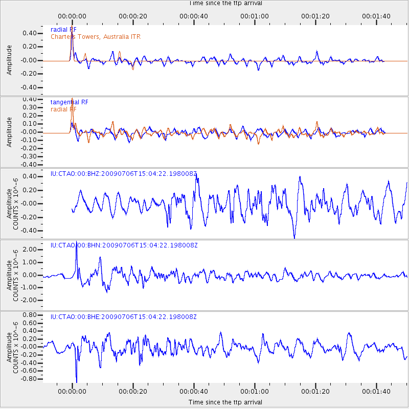
CTAO Charters Towers, Australia - Earthquake Result Viewer
*The percent match for this event was below the threshold and hence no stack was calculated.
| Earthquake location: |
Rat Islands, Aleutian Islands |
| Earthquake latitude/longitude: |
50.4/177.0 |
| Earthquake time(UTC): |
2009/07/06 (187) 14:53:12 GMT |
| Earthquake Depth: |
22 km |
| Earthquake Magnitude: |
6.0 MB, 5.8 MS, 6.1 MW, 6.0 MW |
| Earthquake Catalog/Contributor: |
WHDF/NEIC |
|
| Network: |
IU Global Seismograph Network (GSN - IRIS/USGS) |
| Station: |
CTAO Charters Towers, Australia |
| Lat/Lon: |
20.09 S/146.25 E |
| Elevation: |
357 m |
|
| Distance: |
75.3 deg |
| Az: |
209.782 deg |
| Baz: |
19.752 deg |
| Ray Param: |
$rayparam |
*The percent match for this event was below the threshold and hence was not used in the summary stack. |
|
| Radial Match: |
75.906334 % |
| Radial Bump: |
400 |
| Transverse Match: |
69.911896 % |
| Transverse Bump: |
400 |
| SOD ConfigId: |
2622 |
| Insert Time: |
2010-03-03 14:33:56.215 +0000 |
| GWidth: |
2.5 |
| Max Bumps: |
400 |
| Tol: |
0.001 |
|
Signal To Noise
| Channel | StoN | STA | LTA |
| IU:CTAO:00:BHN:20090706T15:04:22.198008Z | 4.765614 | 7.7005967E-7 | 1.6158667E-7 |
| IU:CTAO:00:BHE:20090706T15:04:22.198008Z | 1.5768651 | 2.578514E-7 | 1.6352153E-7 |
| IU:CTAO:00:BHZ:20090706T15:04:22.198008Z | 1.3311894 | 1.2651145E-7 | 9.5036405E-8 |
| Arrivals |
| Ps | |
| PpPs | |
| PsPs/PpSs | |


