You are here: Home > Network List > IU - Global Seismograph Network (GSN - IRIS/USGS) Stations List
> Station CTAO Charters Towers, Australia > Earthquake Result Viewer
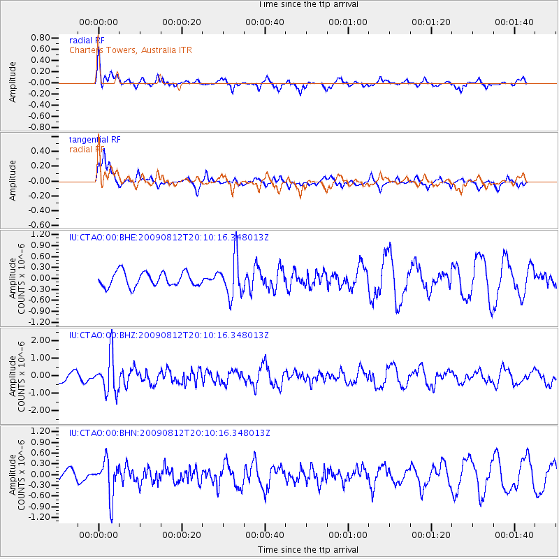
CTAO Charters Towers, Australia - Earthquake Result Viewer
*The percent match for this event was below the threshold and hence no stack was calculated.
| Earthquake location: |
Mindanao, Philippines |
| Earthquake latitude/longitude: |
6.0/126.4 |
| Earthquake time(UTC): |
2009/08/12 (224) 20:04:25 GMT |
| Earthquake Depth: |
96 km |
| Earthquake Magnitude: |
5.6 MB, 5.7 MW, 5.7 MW |
| Earthquake Catalog/Contributor: |
WHDF/NEIC |
|
| Network: |
IU Global Seismograph Network (GSN - IRIS/USGS) |
| Station: |
CTAO Charters Towers, Australia |
| Lat/Lon: |
20.09 S/146.25 E |
| Elevation: |
357 m |
|
| Distance: |
32.5 deg |
| Az: |
143.503 deg |
| Baz: |
320.999 deg |
| Ray Param: |
$rayparam |
*The percent match for this event was below the threshold and hence was not used in the summary stack. |
|
| Radial Match: |
68.56952 % |
| Radial Bump: |
400 |
| Transverse Match: |
71.05462 % |
| Transverse Bump: |
400 |
| SOD ConfigId: |
2622 |
| Insert Time: |
2010-03-03 14:33:57.994 +0000 |
| GWidth: |
2.5 |
| Max Bumps: |
400 |
| Tol: |
0.001 |
|
Signal To Noise
| Channel | StoN | STA | LTA |
| IU:CTAO:00:BHZ:20090812T20:10:16.348013Z | 4.5533357 | 1.1040083E-6 | 2.4246143E-7 |
| IU:CTAO:00:BHN:20090812T20:10:16.348013Z | 3.4377246 | 5.3176086E-7 | 1.5468397E-7 |
| IU:CTAO:00:BHE:20090812T20:10:16.348013Z | 2.8427608 | 5.533451E-7 | 1.9465061E-7 |
| Arrivals |
| Ps | |
| PpPs | |
| PsPs/PpSs | |


